Mount Elbrus
| Mount Elbrus | |
|---|---|
 Mount Elbrus, from the North | |
| Highest point | |
| Elevation | 5,642 m (18,510 ft) [1][2] |
| Prominence | 4,741 m (15,554 ft) Ranked 10th |
| Isolation | 2,473 kilometres (1,537 mi) |
| Listing | Seven Summits Volcanic Seven Summits Country high point Ultra |
| Coordinates | 43°21′18″N 42°26′21″ECoordinates: 43°21′18″N 42°26′21″E |
| Naming | |
| Native name |
|
| Geography | |
| Country | |
| Federal subject | |
| Parent range | Caucasus Mountains |
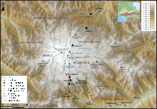
| Topo map | Elbrus and Upper Baksan Valley by EWP[3][4] |
| Geology | |
| Age of rock | Unknown |
| Mountain type | Stratovolcano (dormant) |
| Last eruption | 50 CE ± 50 years[5] |
| Climbing | |
| First ascent | (West summit) 1874, by Florence Crauford Grove, Frederick Gardner, Horace Walker and the guides Peter Knubel and Ahiya Sottaiev (Lower summit) 22 July 1829 by Khillar Khachirov |
| Easiest route | Basic snow/ice climb |
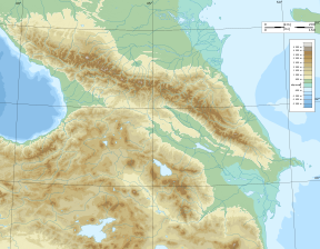
Mount Elbrus (Russian: Эльбру́с, tr. Elbrus, IPA: [ɪlʲˈbrus]; Karachay-Balkar: Минги тау, Miñi taw or Mın̨i taw IPA: [mɪˈŋːi taw]; Kabardian: Ӏуащхьэмахуэ, ’Wāśhamāxwaor Ꜧuas̨hemaxue, IPA: [ʔʷaːɕħamaːxʷa]; Adyghe: Ӏуащхьэмафэ, ’Wāśhamāfa or Ꜧuas̨hemafe, IPA: [ʔʷaːɕħamaːfa]; Hakuchi: Къӏуащхьэмафэ, Qʼuas̨hemafe, IPA: [qʷʼaːɕħamaːfa];) is a dormant volcano in the Caucasus Mountains in Southern Russia, near the border with Georgia. It could be considered the highest mountain in Europe, notwithstanding that the Caucasus mountains are at the intersection of Europe and Asia, and it is the tenth most prominent peak in the world.[6]
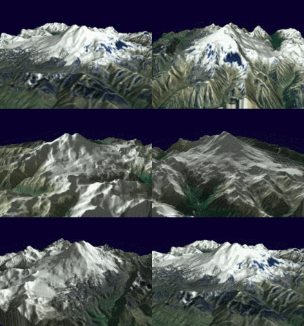
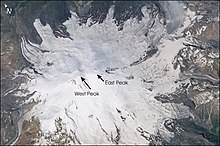
Elbrus has two summits, both of which are dormant volcanic domes. The taller west summit is 5,642 metres (18,510 ft);[2] the east summit is 5,621 metres (18,442 ft). The east summit was first ascended on 10 July 1829 (Julian calendar) by Khillar Khachirov, and the west summit in 1874 by a British expedition led by F. Crauford Grove and including Frederick Gardner, Horace Walker, and the Swiss guide Peter Knubel of St. Niklaus.
While authorities differ on how the Caucasus are distributed between Europe and Asia, most relevant modern authorities define the continental boundary as the Caucasus watershed, placing Elbrus in Europe due to its position on the north side of the watershed in Russia.[6]
Contents
Etymology
The name Elbrus /ˈɛlbrəs/ is a metathesis of Alborz,[7] which is also the name of a long mountain range in northern Iran. It is derived from Avestan Harā Bərəzaitī, which is a legendary mountain in Iranian mythology. Harā Bərəzaitī reflects Proto-Iranian *Harā Bṛzatī, which was reformed into Middle Persian as Harborz, and into Modern Persian as Alborz.[7] Bṛzatī is the feminine form of the adjective *bṛzant ("high"), the reconstructed ancestor of Modern Ossetian bærzond ("high", "peak"), Modern Persian barz ("high"), berāzande ("elegant"), and boland ("high", "tall"),[7] and Modern Kurdish barz ("high"). Harā may be interpreted as "watch" or "guard", from Indo-European *ser ("protect").[7]
Geographical setting
Elbrus stands 20 km (12 mi) north of the main range of the Greater Caucasus and 65 km (40 mi) south-southwest of the Russian town of Kislovodsk. Its permanent icecap feeds 22 glaciers, which in turn give rise to the Baksan, Kuban, and Malka Rivers.[8]
Elbrus sits on a moving tectonic area, and has been linked to a fault. A supply of magma lies deep beneath the dormant volcano.[9]
Eruptive history
Mount Elbrus was formed more than 2.5 million years ago. The volcano is currently considered dormant. Elbrus was active in the Holocene, and according to the Global Volcanism Program, the last eruption took place about AD 50.[5] Evidence of recent volcanism includes several lava flows on the mountain, which look fresh, and roughly 260 square kilometres (100 sq mi) of volcanic debris. The longest flow extends 24 kilometres (15 mi) down the northeast summit, indicative of a large eruption. There are other signs of activity on the volcano, including solfataric activity and hot springs. The western summit has a well-preserved volcanic crater about 250 metres (820 ft) in diameter.[5]
History
The ancients knew the mountain as Strobilus, Latin for "pine cone", a direct loan from the ancient Greek strobilos, meaning 'a twisted object' – a long established botanical term that describes the shape of the volcano's summit. In Greek mythology, the Titan Prometheus was chained to the mountain by Zeus as a punishment for stealing fire from the gods and giving it to mankind.
The lower of the two summits was first ascended on 10 July 1829 (Julian calendar) by Khillar Khachirov, a guide for an Imperial Russian army scientific expedition led by General Emmanuel, and the higher (by about 40 m; 130 ft) in 1874 by an English expedition led by F. Crauford Grove and including Frederick Gardner, Horace Walker, and the Swiss guide Peter Knubel of St. Niklaus in the canton Valais. During the early years of the Soviet Union, mountaineering became a popular sport of the populace, and there was tremendous traffic on the mountain. on 17 March 1936, a group of 33 inexperienced Komsomol members attempted the mountain, and ended up suffering four fatalities when they slipped on the ice and fell to their deaths.[10]
During the Battle of the Caucasus in World War II, the Wehrmacht occupied the area surrounding the mountain from August 1942 to February 1943 with Gebirgsjäger from the 1st Mountain Division.[11] The Nazi Swatstika was placed on the summit of Mount Elbrus on 21 August 1942.[12] A possibly apocryphal story tells of a Soviet pilot being given a medal for bombing the main mountaineering hut, Priyut 11 (Приют одиннадцати, "Refuge of the 11"), while it was occupied. He was then later nominated for a medal for not hitting the hut, but instead the German fuel supply, leaving the hut standing for future generations. When news reached Adolf Hitler that a detachment of mountaineers was sent by the general officer commanding the German division to climb to the summit of Elbrus and plant the swastika flag at its top, he reportedly flew into a rage, called the achievement a "stunt" and threatened to court martial the general.[13][14]
The Soviet Union encouraged ascents of Elbrus, and in 1956 it was climbed en masse by 400 mountaineers to mark the 400th anniversary of the incorporation of Kabardino-Balkaria, the Autonomous Soviet Socialist Republic where Elbrus was located.
From 1959 through 1976, a cable car system was built in stages that can take visitors as high as 3,800 metres (12,500 ft). There are a wide variety of routes up the mountain, but the normal route, which is free of crevasses, continues more or less straight up the slope from the end of the cable car system. During the summer, it is not uncommon for 100 people to be attempting the summit via this route each day. Winter ascents are rare, and are usually undertaken only by very experienced climbers. Elbrus is notorious for its brutal winter weather, and summit attempts are few and far between. The climb is not technically difficult, but it is physically arduous because of the elevations and the frequent strong winds. The average annual death toll on Elbrus is 15–30, primarily due to "many unorganized and poorly equipped" attempts to summit the mountain.[15]
Since 1986, Elbrus has been incorporated into Prielbrusye National Park, one of the Protected areas of Russia.
Elbrus should not be confused with the Alborz (also called Elburz) mountains in Iran, which also derive their name from the legendary mountain Harā Bərəzaitī in Persian mythology.
In 1997 a team led by the Russian mountaineer Alexander Abramov took a Land Rover Defender to the summit of the East Peak, breaking into the Guinness Book of Records.[16]The project took 45 days in total. They were able to drive the vehicle as high as the mountain huts at The Barrels (3,800 metres (12,500 ft)), but above this they used a pulley system to raise it most of the way. on the way down, a driver lost control of the vehicle and had to dive out. Although he survived the accident, the vehicle crashed into rocks and remains below the summit to this day.[17]
In 2016, Russian climbers Artyom Kuimov and Sergey Baranov entered the Guinness Book of World Records by reaching the summit of Elbrus on ATVs.[18]
Due to the North Caucasus insurgency travel to Mount Elbrus has become increasingly difficult. The U.S. State Department has issued a travel advisory against climbing the mountain, as well as travel to the North Caucasian Federal District in general, due to the risk of terrorism and political instability.[19]
Infrastructure
Refuges In 1929, eleven scientists erected a small hut at 4,160 metres and called it "Priyut 11" (Refuge of the 11). At the same site, a larger hut for 40 people was built in 1932.
A wilderness hut was built in 1933 in the saddle between the two summits but collapsed after only a few years. Its remains can still be seen.
In 1939, the Soviet Intourist travel agency built yet another structure a little above the "Priyut 11" site at 4,200 metres, covered in aluminium siding. It was meant to accommodate western tourists, who were encouraged to climb Mount Elbrus in commercial, guided tours at the time to bring in foreign currency.
Not much later, this hut was converted into a mountain barracks, serving as a base, first for Soviet and later German troops in the Battle of the Caucasus of World War II.
On 16 August 1998, this hut completely burned down after a cooking stove fell over. After that, the new "Diesel hut" was built in the summer of 2001 a few metres below its ruins, so called because it is located at the site of the former Diesel generator station.
In addition, there is a collection of accommodations for six people each at the end of the short chairlift upwards of the second cableway section. Painted red and white, these horizontal steel cylinders (called Barrels, Russian bochki), are used as a base and for acclimatization by many mountaineers on their way to the summit. Beside the "Barrels", there are several container accommodations between about 3,800 and 4,200 metres.
Observatory
The Terskol Observatory, an astronomical observatory with the IAU code B18, is located 2.5 km north-west of Terskol village at an altitude of 3,090 metres (10,140 ft).[20][21]
Climbing routes
The Normal Route is the easiest, safest and fastest on account of the cable car and chairlift system which operates from about 9 a.m. till 3 p.m. Starting for the summit at about 2 a.m. from the Diesel Hut or Leaprus mountain hut should allow just enough time to get back down to the chairlift if movement is efficient. A longer ascent Kiukurtliu Route starts from below the cable-way Mir station and heads west over glacier slopes towards the Khotiutau pass.
The ascent of Elbrus from the south takes about 6–9 hours, with a total height difference of 1,700–2,000 m (5,600–6,600 ft) between the Barrels Huts and the west summit of Elbrus. From Terskol village one can walk 5 km (3.1 mi) to the first elevation, Azau (2,350 m; 7,710 ft). A cable car service is available from Azau to the normal starting location for the Elbrus climb, known as Barrels Hut or Garabashi Station (3,720 m; 12,200 ft). The next destination – the Diesel Hut at 4,050 m (13,290 ft) – is located south from the Barrels Huts and up the slopes of Elbrus. From the Diesel Hut the route heads straight up towards the east summit of Elbrus, continuing south up the slopes. The slopes surrounding the classical route to Elbrus from the South contain large crevasses. Heading towards Pashtuhova Rocks (at 4,550–4,700 m (14,930–15,420 ft) elevation), the classical route up Elbrus becomes steeper after passing between two linear rock bands. After leaving this section, the Elbrus route heads on – first northward, to the east summit of Elbrus, or rather the saddle between the east and west summits of Elbrus (5,416 m; 17,769 ft), but soon turns left to the west summit (5,642 m; 18,510 ft). Before reaching this saddle, the route passes through a gently sloped basin filled with snow. At the saddle there is a shelter, from which the route heads west, then – left, in the direction of rocks forming the shoulder of the west summit, in the form of a narrow, exposed snow path that allows for a straight dash to the summit ridge.
The descent of Elbrus takes about 3–6 hours. While returning from the Elbrus summit, the most common mistake that climbers make and that often turns out fatal is heading low and down too early after their half-traverse below the saddle, especially under conditions of low visibility in stormy weather. on descent after the saddle, instead of going down the slope too early, one could stay high up on the slopes of the east peak, otherwise the route will become very steep and feature dangerous crevasses and falls.
The north climbing route requires more commitment and is more remote than the south route. Also contributing to this is the fact that on the lower altitudes of the mountain this route can offer less in the way of infrastructure. However, this also means less human intrusion onto the landscape. With mechanical support brought to minimum, the tour to Elbrus from the north is mainly camping, with the summit route being longer and harder, and requiring good teamwork and/or winter camping skills since, if the weather is favorable, it involves an interim camp at 4,800 m (15,700 ft) or gaining 2000 vertical meters/6561 vertical ft up and down. Elbrus ascent by the north route offers rich ice and snow experience under unpredictable weather conditions.
Elbrus Race
The first race on Elbrus took place in 1990, with Soviet and American climbers competing. The race was won by Anatoli Boukreev, with Kevin Cooney in second, followed by Patrick Healy. Route Priut 11 (4050 m) – East (lower) was summited in 1 hour and 47 minutes.[22]
Regular competitions began to take place in 2005, with a choice of two routes: the "classic" climb from "Barrels" at 3708 m to the western summit (5642 m) and a long climb, from the Azau Meadow at 2350 m to the same summit. In 2006, Denis Urubko won the long ascent in 3 hours 55 minutes 59 seconds.[22]
On 24 September 2010, under the Artur Hajzer program "Polish Winter Himalayism 2010–2015", the Polish Mountaineering Association sent a 13-person team for training purposes. Andrzej Bargiel set a new long course record of 3 hours 23 minutes 37 seconds.[23]
The record time for the full race, ascent and descent, of the long route is 4:20:45, set on 7 May 2017 by Swiss-Ecuadorian mountain guide Karl Egloff. Egloff broke the previous record set in September 2014 by Vitaliy Shkel by more than 18 minutes. He reached the summit in 3:24:14, missing Bergiel's record ascent-only time by 37 seconds; the race organization and the International Skyrunning Federation nevertheless consider Egloff's ascent a record as well.[24][25][26]
The fastest times by a woman on the long route were set by Diana Zelenova (4:30:12 for the ascent in 2017) and Oksana Stefanishina (6:25:23 for the full race in 2015). [26]
Environmental issues
Mount Elbrus is said to be home to the 'world's nastiest' outhouse which is close to being the highest privy in Europe. The title was conferred by Outside magazine following a 1993 search and article.[27] The "outhouse" is surrounded by and covered in ice, perched off the end of a rock.[28]
See also
'코카서스' 카테고리의 다른 글
| <펌> Urartu - Kingdom of Van (0) | 2019.07.27 |
|---|---|
| <펌> Lake Van (0) | 2019.07.27 |
| <펌> Mount Ararat (0) | 2019.07.27 |
| <펌> Gori (0) | 2019.07.11 |
| <펌> Ancient Georgian Iron metallurgy and its ore base (0) | 2019.07.11 |


