I. 머리말
지난 글에서 코카서스 산맥 아래에서 광개토태왕의 비문에 나타나는 고리성에 대해서 찾아본 연구를 하였다. (아래 글 참조)
https://paulcgpark.tistory.com/119
광개토태왕이 정복한 고리성은 코카서스의 Gori Fortress인가?
I. 서 론최근의 코카서스에서의 가잠성, 관산성 전투 연구에 의하면 신라 백제가 이 지역에서 치열하게 싸웠다. 그리고 그 북쪽에는 고구려로 보이는 훈족의 세력이 있었다. 그런데 코카서스
paulcgpark.tistory.com
그때 훈족이 395년 봄과 겨울에 각각 코카서스산맥 아래와 발칸반도를 진출하였다 했다. 그래서 396년에는 다뉴브강인 아리수(아래 필자의 글 참조)를 건너 광개토태왕이 본격적으로 백제를 강습하는 시기이다. (아래 자료 참조)
여기까지 광개토대왕의 정벌활동을 정리하면 다음과 같다.
一年夏五月 광개토왕이 즉위하다 (AD 391)
二年秋七月 10개의 백제성을 빼앗다 (AD 392)
二年秋九月 거란을 정벌하다 (AD 392)
二年冬十月 백제 관미성을 빼앗다 (AD 392)
三年秋八月 백제의 침략을 물리치고 평양에 사찰을 창건하다 (AD 393)
四年秋七月 정예 기병으로 백제의 침략을 물리치다 (AD 394)
四年秋八月 나라 남쪽에 7성을 쌓다 (AD 394)
四年秋八月 패수에서 백제와 싸워 이기다 (AD 394)
AD 395-398 : 4년 공백
(자료 : 광개토태왕, 삼국사기, 나무위키)
392년 남으로 백제 침공, 북으로 거란 침공.
395년 남으로 백제 방어, 북으로 비려 침공.
396년 대대적인 백제 강습
(자료 : 광개토태왕, 나무위키)
https://blog.naver.com/lainfos/223508765747
광개토태왕이 건너 백제를 공격한 아리수는 다뉴브강인가?
필자는 이미 과거에 광개토태왕이 건넌 아리수(阿利水)를 다뉴브강이라 추정했었다. "백잔(百殘)[17]...
blog.naver.com
따라서 광개토태왕 비문에 나오는 산나성, 사수성, 파노성에 대해서 발칸반도 아래 있는지 여부를 본격적으로 살펴 보고자 한다. 일견 파노성이란 이름은 발칸반도 아래 파노니아 지방 이름에서 비롯된 것이 아닌가 하는 추정과 사수성이란 이름은 강이름 사수(沙모래사, 水물수)에 가까이 있는 성이란 추정이 가능한데, 발칸반도에 사수 (Sasu river)가 있기 때문이다. 같은 논리로 산나(散흩을 산, 那어찌나)성은 한자의 뜻보다 음가차환의 가능성이 큰데, 발칸반도에 Sana river가 있기 때문이다. 이러한 가정하에 발칸반도에서 이들의 성이 있을 가능성을 추정해 보고자 한다.
II. 본 론
1. 광개토태왕의 발칸반도 진출 가능성
아래 내용을 보면 훈족은 395년 겨울 다뉴브강을 건너 대대적인 공격을 하였다. 트라키아 지방을 유린하고 달마티아 지역을 위협했다. 트라키아 지방은 지금의 루마니아, 보스니아 헤르체고비나이고 달마티아는 지금의 크로아티아이다. 아래 지도는 훈족의 장수 Uldin의 진격방향을 보여 준다. 그리고 이들 훈족이 로마침입시 고트족의 Alaric I왕과 합류했다는 것은 이들은 하나의 무리라는 판단을 가능하게 한다. 필자는 이들이 고구려 세력이라 믿는다. 특히 고트족의 Alaric I왕은 고구려의 광개토태왕으로 추정된다. 재위기간이 매우 유사하고, 그의 정복 경로가 광개토태왕의 비문의 성들 위치와 매우 일치한다.
"First large scale attack on Rome and Persia[edit]
In 395 the Huns began their first large-scale attacks on the Romans. In the summer of that year, the Huns crossed over the Caucasus Mountains, while in the winter of 395, another Hunnic invasion force crossed the frozen Danube, pillaged Thrace, and threatened Dalmatia.[56] Sinor argues that these two events were likely not coordinated,[57] but Kim believes they were.[48] The forces in Asia invaded Armenia, Persia, and the Roman provinces in Asia. One group crossed the Euphrates and was defeated by a Roman army, while two armies, recorded in later sources as under the leadership of Basich and Kursich, rode down the Euphrates and threatened the Persian capital of Ctesiphon. One of these armies was defeated by the Persians, while the other successfully retreated by Derbend Pass.[57] A final group of Huns ravaged Asia Minor.[58] The Huns devastated parts of Syria and Cappadocia, threatening Antioch.[59] The devastation was worse because most Roman forces had been moved to the West due to Roman power struggles there.[60] In 398 Eutropius finally succeeded in gathering an army and restoring order in the province.[61] It seems likely, however, that the Huns left of their own accord without Eutropius having defeated them in battle.[57][62]
.............
Uldin은 광개토태왕의 재위기간과 매우 유사하여 동일인이 아닌가 하였으나, 그 밑의 총사령관으로 직책을 가진 장군이 아닌가 한다.
Uldin[edit]
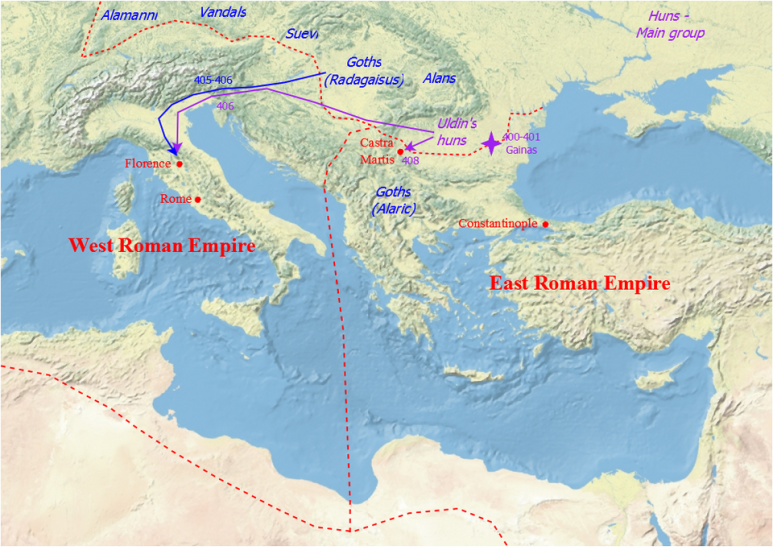
Campaigns of Uldin
Uldin, the first Hun identified by name in contemporary sources,[68] is identified as the leader of the Huns in Muntenia (modern Romania east of the Olt River) in 400.[69] It is unclear how much territory or how many tribes of Huns Uldin actually controlled, although he clearly controlled parts of Hungary as well as Muntenia.[70] The Romans referred to him as a regulus (sub-king): he himself boasted of immense power.[71]
In 400, Gainas, rebellious former Roman magister militum fled into Uldin's territory with an army of Goths, and Uldin defeated and killed him, likely near Novae: he sent Gainas's head to Constantinople.[69] Kim suggests that Uldin was interested in cooperating with the Romans while he expanded his control over Germanic tribes in the West.[72] In 406, Hunnic pressure seems to have caused groups of Vandals, Suebi, and Alans to cross the Rhine into Gaul.[73] Uldin's Huns raided Thrace in 404–405, likely in winter.[74][75]
(source : History of Huns, wikipedia, 인용출처 : 필자의 네이버 블로그(lainfos), 카테고리, Huns)
아래 Pannonia 지방의 설명 자료에서도 서고트족, 훈족, 아틸라의 행적을 말하고 있다.
In the 4th century, the Romans (especially under Valentinian I) fortified the villas and relocated barbarians to the border regions. In 358 they won a great victory over the Sarmatians, but raids did not stop. In 401 the Visigoths fled to the province from the Huns, and the border guarding peoples fled to Italia from them, but were beaten by Uldin in exchange for the transferring of Eastern Pannonia. In 433 Rome completely handed over the territory to Attila for the subjugation of the Burgundians attacking Gaul.[91]
After Roman rule
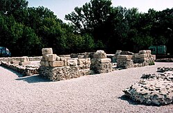
Gerulata, a Roman military camp located near today's Rusovce, Slovakia
아래 자료에서는 433년이후 훈족이 이 지역에 거주하고, 454년 이후에는 동고트족이 거주했다 기록한다. 6세기의 Justinian I의 복구이후에는 다시 비잔틴의 땅이 되었다 한다. 이후 이 지역은 560년 이후 아바르족과 슬라브족의 영역이 되었다가, 790년이후 프랑크족의 침입을 받는다. (아래 내용 참조)
필자는 Justinian I이 백제의 성왕이라 추정하고, 아바르족은 말갈이라 추정한다. 그리고 790년 이 지역을 침범한 프랑크왕국은 당나라로 추정한다.
During the Migration Period in the 5th century, some parts of Pannonia were ceded to the Huns in 433 by Flavius Aetius, the magister militum of the Western Roman Empire.[92] After the collapse of the Hunnic empire in 454, large numbers of Ostrogoths were settled by Emperor Marcian in the province as foederati. The Eastern Roman Empire controlled southern parts of Pannonia in the 6th century, during the reign of Justinian I. The Byzantine province of Pannonia with its capital at Sirmium was temporarily restored, but it included only a small southeastern part of historical Pannonia.
Afterwards, it was again invaded by the Avars in the 560s, and by the Slavs, who may have first settled around the 480s but only became independent starting in the 7th century. In 790s, it was invaded by the Franks, who used the name "Pannonia" to designate the newly formed frontier province, the March of Pannonia. The term Pannonia was also used for the Slavic polity of Lower Pannonia, which was vassal to the Frankish Empire.
Through Roman influence, a dialect of Latin now called Pannonian Latin developed in the region; the several major political shifts would see it go extinct around the 6th century.[93]
(source : Pannonia, wikipedia, 인용출처 :필자의 네이버 블로그(lainfos), 카테고리, Illyria/Dalmatia)
2. 산나성의 위치 추정
산나성(散那城)의 한자를 보면, 별 뜻이 없으므로 음가 차환의 글자로 보인다. 즉 '산나' 라는 발음을 가진 지역이라는 곳에 있는 성이란 것이다. 산나성(散那城)은 백제 공취성 중의 하나일 뿐 아니라광개토왕 비문의 수묘인 성중의 하나로 '1가가 국연'으로 적혀 있다.
그런데 다뉴브강 아래 이 발칸지역에 Sana라는 강이 있다. (아래 자료 및 지도 참조) 산나강은 Una강에 합류하고, Una강은 다시 Sava강에 합류하고, Sava 강은 다뉴브강에 합류한다.
The Sana (Serbian Cyrillic: Сана, pronounced [sǎːna]) is a river in the north-western part of Bosnia and Herzegovina. It is a tributary of the Una, which it flows into at Novi Grad. It is the longest of the nine rivers that flow through Sanski Most, and is 142 km long. It is not a navigable waterway.
|
Basin features
|
|
|
Progression
|
Una→ Sava→ Danube→ Black Sea
|
(source : Sana (river), wikipedia, 인용출처:필자의 네이버 블로그(lainfos), 카테고리, 발칸반도강)
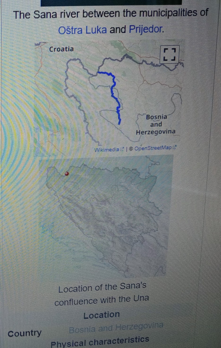
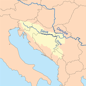
따라서 Sana강 주위에 어떤 성곽들이 있는가 구글에서 AI를 빌어 알아 보니 다음과 같이 Kljuc Castle과 Prizren Castle이 언급된다.
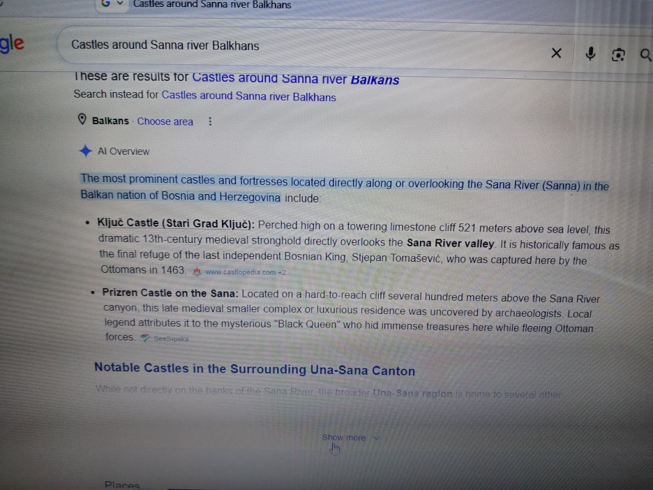
1) Kljuc Stari Grad Castle
Kljuc castle은 산 정상에 있는 성으로서 언제 건축되었는지 알 수 없다 한다. 지형이 화강암 바위로 되어 있어 방어하기 용이하며, 중세의 성곽으로서는 규모가 큰, 높이 7미터, 두께 3.5미터인 외곽 성벽(outer rampart)이 있다 한다. (아래 자료 참조)
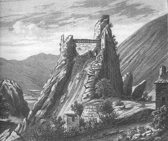
Stari Grad Kljuc Fortress, Bosnia and Herzegovina
Ključ fortrass, locally known as Stari grad Ključ (transl. Old Town Ključ), is a medieval castle complex in the village of Ključ, Gacko, Bosnia and Herzegovina. The historic area includes the Ključ fortress, the Podključ castle town (in Serbo-Croatian: podgrađe, lit. transl. below-town or under-town) as part of a wider area just beneath of the fortress, the Ključ Mosque (Ajnebeg-dede Mosque, Ključ Captains' Mosque or Starica) with a harem. ...
Ključ medieval castle complex is located in the village of Ključ, northeastern Herzegovina, in the Republika Srpska entity of Bosnia and Herzegovina. The remains of Ključ are located on the extreme southwestern slope of the Babe mountain, under Rudi brdo (1,167 m)...
The date of the construction is unknown, however by 1426 the site was used as a regional powerbase and 'capital' of the Grand Duke Sandalj[1] Ključ, which translates as Key, was the residence of Sandalj Hranić, the most powerful Bosnian[2] nobleman in the region during the period, and one of his most important fortified cities.
.....
Architecture
The position of the walls is limited by limestone boulders at the junction of the outer rampart, while the rocky terrain protects the eastern rampart of the upper town to the extreme. It has an entrance with door frames 1.70 metres (5.6 ft) high and 0.80 metres (2.6 ft) wide. The terrain is levelled in front of the lower threshold, and above it are the steps for the exit to the guard path. The interior encloses a courtyard space of 51 metres (167 ft) by 19.2 metres (63 ft) and on the highest ridge rises the main tower of a quadrangular base, 8 metres (26 ft) by 8 metres (26 ft) with a wall 1.80 metres (5.9 ft) thick. South of the main entrance is a square tower 7 metres (23 ft) by 40 metres (130 ft) that served as a dungeon. With walls 0.80 metres (2.6 ft)-1 metre (3.3 ft) wide, with a supervised secret exit for the lower town. Above the northeastern ramparts, cannon openings and numerous loopholes can be seen. On the walls of the main tower, a much smaller number of openings for firearms and cold steel can be seen. Perhaps the most important description of the city's architecture is the outer rampart of the upper town, about 7 metres (23 ft) high and up to 3.50 metres (11.5 ft) wide, unusual for medieval Bosnian towns. Access to the main entrance of the upper town was made through a side wall 2 metres (6.6 ft) and 1.40 metres (4.6 ft). Along with it, the remains of an unidentified residential building on the way to the dungeon can be recognized. With Herzegovina's rule, Kljuc lost its political role, but its strategic and economic value grow. Then the walls were reinforced with a medieval opus incertum filled with trpanca in lime mortar.
(source : Kljuc castle (Gacko), wikipedia, 인용출처 :필자의 네이버 블로그(lainfos), 카테고리, 보스니아 헤르체코비나)
상기 그림에서는 원형의 타워가 보이지 않는다. 사각의 타워는 보이는데, 사가의 타워는 로마시대의 타워로 추정된다.
2) Prizren castle
최근에 발견된 Sana강 위에 있는 하기 Prizren성은 접근하기 어려운 절벽위에 있는 성의 잔재인데, 워치 타워로서 기능을 한 것으로 보인다. 그러므로 성이라고 하기에는 너무 규모가 작다.
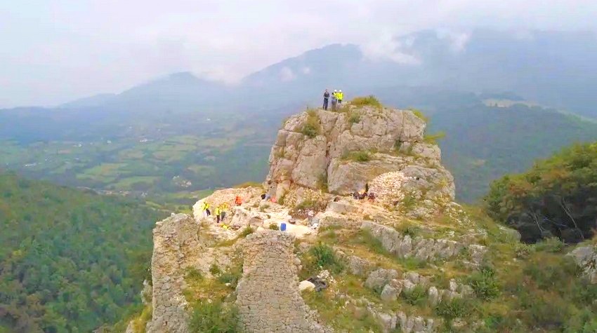
Prizren castle on the Sana river, Bosnia Herzegovina
Have you ever passed by Prizren on the Sana, a mysterious site of unusual beauty? As you gaze toward the canyon of the Sana River, you might wonder who, when, and why built the architectural complex on top of that hard-to-reach cliff, several hundred meters above the river. ...
이상으로 살펴 본 성들은 산나성이라 하기 판단이 어려우므로, 보다 영역을 넓혀 산나-우나 지방 주위의 성곽을 알아 보았다. Ostrozac castle, Velika Kladusa Castle, Bosanska Krupa castle의 3개가 언급된다.
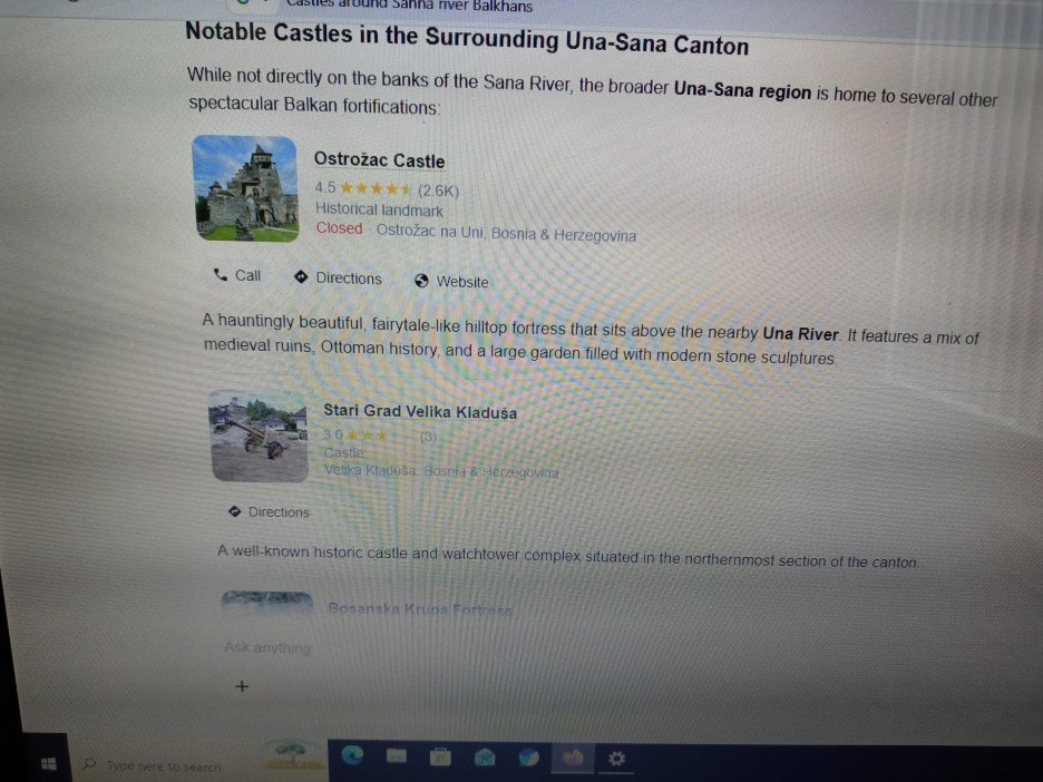
3) Ostrozac castle
Ostrozac castle은 규모도 있고, 원형 타워의 모습도 보인다. (아래 사진 참조). 그러나 건축 시기는 중세 13세기를 언급한다. 중세에 증축한 것일 수 있다. 일단 후보로 보인다.
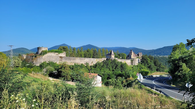
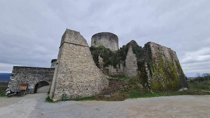
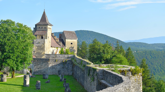
Ostrozac Castle, Una-Sana river, Bosnia and Herzegovina
Ostrožac Castle (Bosnian) is a castle located in Bosnia and Herzegovina in the Una-Sana Canton on the outskirts of the town of Cazin, in the village of Ostrožac. The castle dates back to the 13th century when Ostrožac was part of property of the Croatian noble house of Babonić. In 1592 it was captured by the Ottoman Empire and established as an Ottoman province of Bosnia.
(source : Ostrožac Castle, wikipedia, 인용출처: 필자의 네이버 블로그(lainfos),카테고리, Bosnia Herzegovina)
4) Stari Grad Velika Kladusa Castle
Velika Kladusa castle은 아래 그림에서 보는 것처럼, 산 정상에 있는 성으로서 내부에 원형 타워가 있다. 또한 고구려의 치 모습의 원형 감시탑도 보인다.
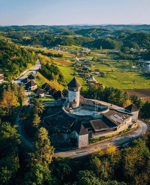
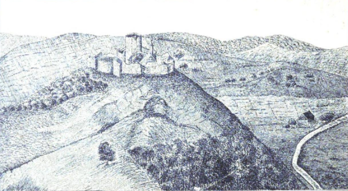


The castle is situated on the right side of the river Grabarska, which is a tributary of the river Kladušnica.
History
The Velika Kladuša Castle is first mentioned in historical sources in 1280 under King Ladislaus IV of Hungary....
The castle boasted great strategic importance for the Ottoman conquests towards Croatia.[1]
...
The castle was refurbished and repurposed into a tourist establishment.
(source : Velika Kladusa castle, wikipedia, 인용출처:필자의 네이버 블로그(lainfos), 카테고리, Bosnia Herzegovina)
단 1280년에 처음 언급되었다 하고, Sana-Una Canton의 조그만 강가에 위치한다. 원형 감시탑의 존재는 후보로서 판단하게 한다. 상기 2개의 성은 강에서 다소 떨어져 있다. 그러나 아래 Bosanska Krupa Fortress는 강가에 위치한다.
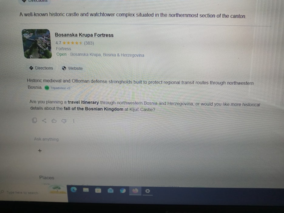
5) Bosanska Krupa Fortress
Bosanska Krupa Fortress는 Una강가에 위치하며, 원형 타워가 근간을 이룬다. 아래에는 민가도 접해 있어 성곽으로서 규모가 있다. 이와 관련 자료가 벌로 없어 아쉬우나, 산나성의 강력한 후보 중의 하나로 판단된다.
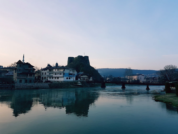
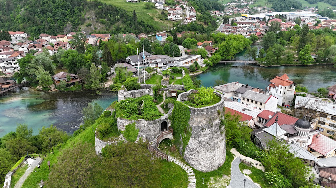
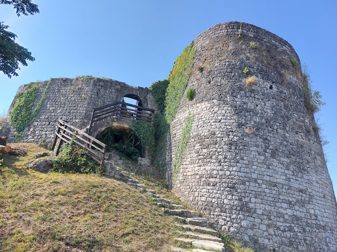
Bosanska Krupa Fortress, Una-Sana river, Bosnia and Herzegovina
Krupa fortress
Krupa castle (first mentioned in the 13th century), on a cliff above the river Una, had one large and two minor round towers connected with bulwarks. Under the castle was a large settlement, fortified with a wall with two towers (later adapted for artillery) and a gatehouse. Until 1456, it was the property of Croatian nobility, and after it passed to the king.[3]
(source : Siege og Krupa, wikipedia)
3. 사수성의 위치 추정
사수성(沙水城)(沙(모래사)水(물수))은 강이름 사수에 접한 성으로 판단된다. 또한 사수성은 광개토태왕 비문에 기록된, 사수성 (韓濊) : 국연 1, 간연 1의 수묘인성이다. 한예(韓濊)지방으로 기록되었는데, 필자는 동예가 이 지역에 있었다 추정한 바 있다. (아래 필자의 글 참조)
https://lainfos.tistory.com/62
동예가 있는 창해는 어디인가?
우리는 역사에서 창해에 대한 아래 4번의 언급을 본다. 이 창해에 대한 위치추정이 매우 중요하다. 왜냐하면, 창해는 동예의 위치를 알려 주며, 또한 신라와 금관가야와 관련 있는 실직곡국의 위
lainfos.tistory.com
https://lostcorea.tistory.com/1538
동예가 있는 창해는 어디인가 (2)?
창해는 푸를 창(蒼) 또는 큰 바다 창 (滄)자를 쓴다. 한무제 당시에 예군 남려가 항복하여 세운 창해군은 푸를 창(蒼)자를 썼다. 반면 조조가 갈석산에 올라 창해를 바라보고 시를 읊었다는 창해
lostcorea.tistory.com
이제 사수가 어디인지 살펴 보자. 위키피디아 기록에 의하면 사수 Sasu는 루마니아에 있는 강이다. (아래 지도 참조). Strei강의 지류이다.
Sasu river (Romania)
The Sasu is a river in the Șureanu Mountains, north of Petroșani, Romania. It is a left tributary of the Strei.[1][2] Its length is 10 km (6.2 mi) and its basin size is 17 km2 (6.6 sq mi).[2]
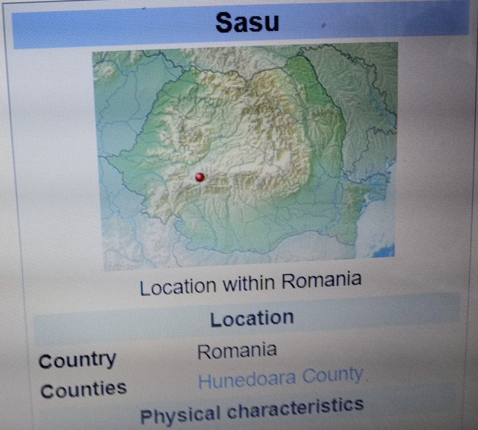
Strei강은 Mures강의 지류이며, Mures강은 Tisza강을 거쳐 다뉴브강으로 흘러 들어 간다. (아래 자료 및 지도 참조)
The Strei (Hungarian: Sztrigy) is a left tributary of the river Mureș in Transylvania, Romania.[1][2] The upper reach of the river, upstream of the village of Baru, is also known as Râul Petros.
|
Basin features
|
|
|
Progression
|
Mureș→ Tisza→ Danube→ Black Sea
|
(source : Strei (river), wikipedia, 인용출처 :필자의 네이버 블로그(lainfos), 카테고리, 발칸반도강)
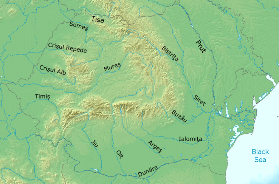
Major rivers in Romania (source : wikipedia)
Sasu가 현재 10km의 조그만 강이므로 합류하는 Strei강 주위의 성곽이 있는지 알아 보자. 이 근처에서는 Corvin Castle이 유일하게 거론된다. (아래 자료 참조)

1) Corvin Castle
Corvin Castle은 루마니아에 있는 성으로서 Hunedora Castle 또는 Hunyadi Castle이라 불린다 한다. 이름에서 훈족이 연상된다.
Corvin Castle, also known as Hunyadi Castle or Hunedoara Castle (Romanian: Castelul Huniazilor or Castelul Corvinilor; Hungarian: Vajdahunyadi vár), is a Gothic-Renaissance castle in Hunedoara, current-day Romania. It is considered one of the largest castles in Europe and is one of the Seven Wonders of Romania.[1][2][3]
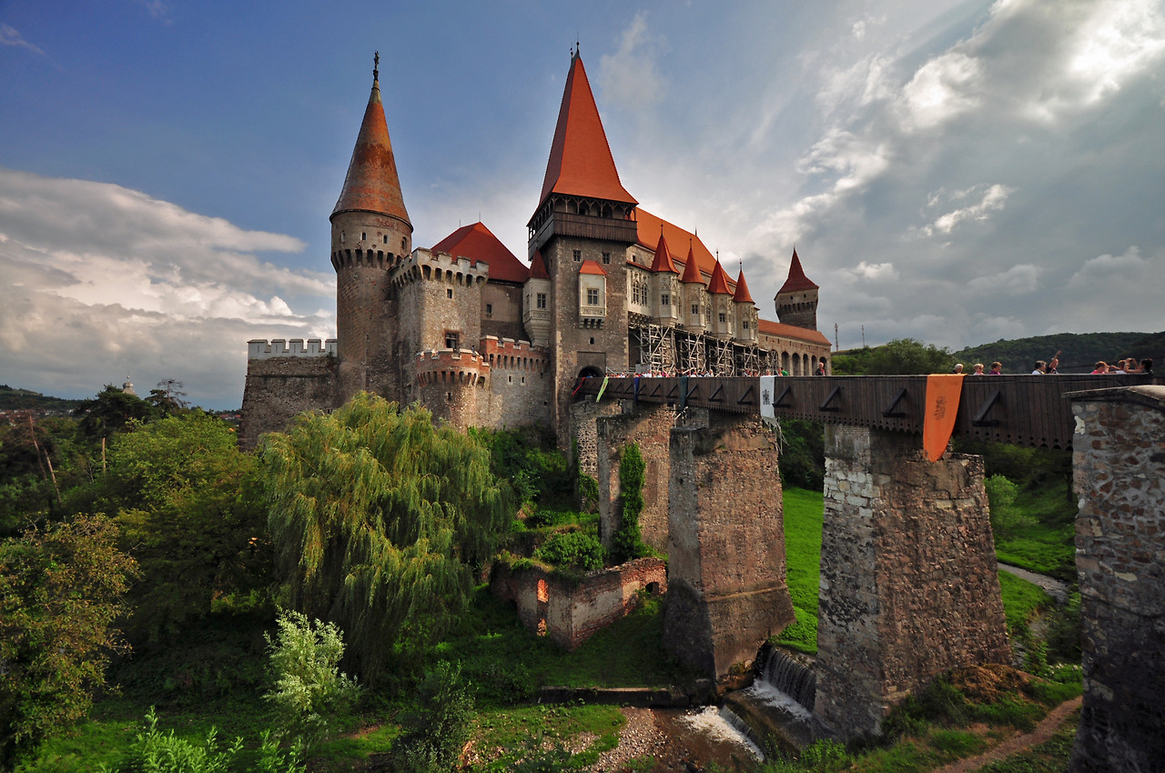
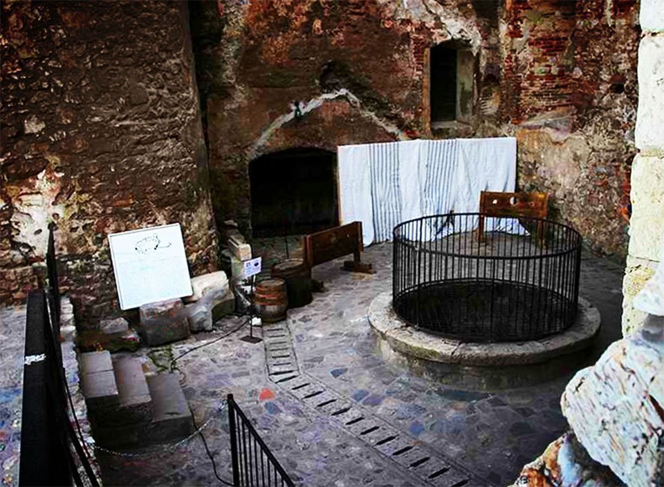
Corvin Castle, Romania
상기 사진을 보면, 원형 타워가 있는데, 이후 증축 보수한 것으로 보이며, 바로 앞에 다리가 있다는 것은 과거에 이 다리 밑으로 물이 흘렀다는 것을 의미한다. 아마 사수가 이 다리 밑에 흘렀는데, 지금은 말라 없어진 것 아닌가 한다. 특히 성안에 우물이 있는 사진이 눈에 띈다. 고구려의 성곽안에는 우물이 있었다 한다.
아래 기록에서는 15세기에 지은 것으로 나타나는데, 그 양식이 르네상스-고딕 양식이라 한다. 고딕양식은 고트족의 양식을 의미한다. 필자는 고트족이 고구려라 추정했다. 드라큘라 영화에서 드라큘라 성의 영감의 장소로 언급된다 한다. 드라큘라는 당시의 무서운 훈족을 상징하는 것이 아닌가 한다. 규모가 커서 루마니아 7대 불가사리 중의 하나라 한다. 사수성의 강력한 후보라 판단된다.
.......
Corvin Castle was laid out in 1446, when construction began by order of Voivode of Transylvania John Hunyadi (Hungarian: Hunyadi János, Romanian: Iancu or Ioan de Hunedoara), who wanted to transform the former keep built by Charles I of Hungary. The castle was originally given to John Hunyadi's father, Woyk (Vajk, Voicu), by Sigismund of Luxembourg, king of Hungary and Croatia, as a severance in 1409.[4] It was also in 1446 that John Hunyadi was elected as the regent governor by the Diet.
The castle has three large areas: the Knight's Hall, the Diet Hall, and the circular stairway. The halls are rectangular in shape and are decorated with marble. The Diet Hall was used for ceremonies or formal receptions, whilst the Knight's Hall was used for feasts. In 1456, John Hunyadi died, and work on the castle stagnated. Starting with 1458, new commissions were being undertaken to construct the Matia Wing of the castle. In 1480, work was completely stopped on the castle, and it was recognised as being one of the biggest and most impressive buildings in Eastern Europe............
Built in a Renaissance-Gothic style and constructed over the site of an older fortification on a rock above the smaller Zlaști River, the castle is a large and imposing structure with tall towers, bastions, an inner courtyard, diversely coloured roofs, and myriad windows and balconies adorned with stone carvings. The castle also features a double wall for enhanced fortification and is flanked by both rectangular and circular towers, an architectural innovation for the period's Transylvanian architecture. Some of the towers (the Capistrano Tower, the Deserted Tower, and the Drummers' Tower) were used as prisons. The Buzdugan Tower (named after a type of mace) was solely built for defensive purposes, and it had its exterior decorated with geometric motifs. The rectangular towers have large openings to accommodate larger weapons.....
Corvin Castle is sometimes mentioned as a source of inspiration for Castle Dracula in Bram Stoker's 1897 horror novel Dracula, although Stoker was unaware of the castle's connection to Vlad the Impaler.[8]
(source : Corvin castle, wikipedia, 인용출처: 필자의 네이버 블로그(lainfos), 카테고리, Romania)
2) Deva Fortress
그런데, Corvin Castle 바로 옆에 산정상에 Deva Fortress가 있다. (아래 그림 참조) 역시 원형 타워가 있고 산 정상에 있는 고구려 성곽의 모습이다.
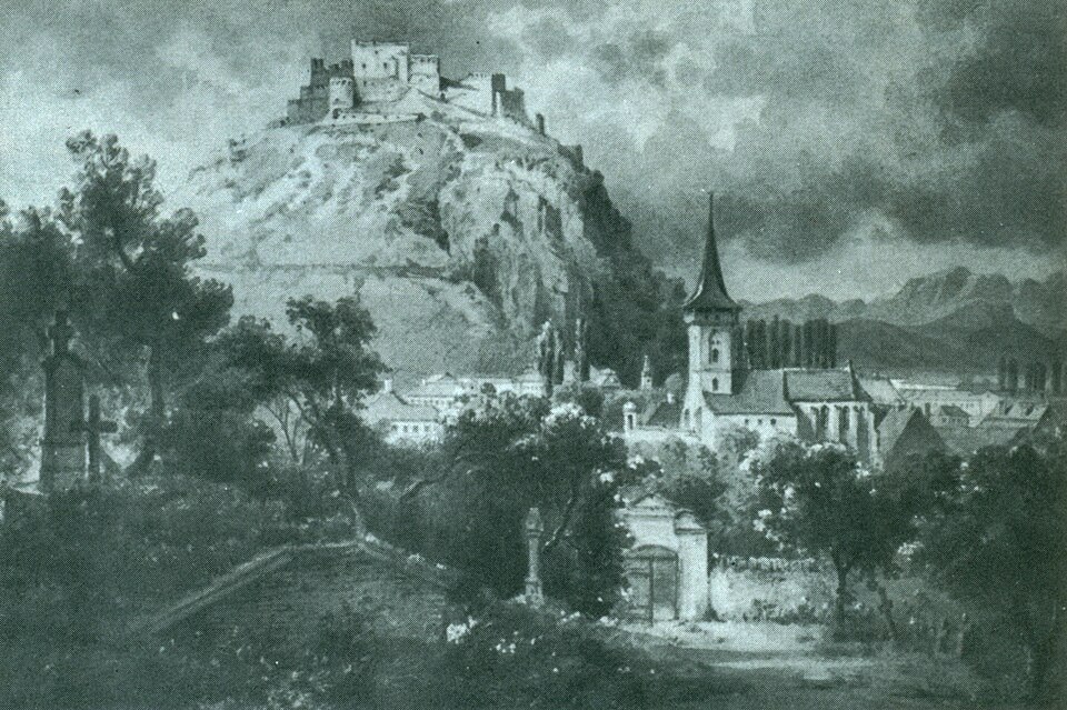

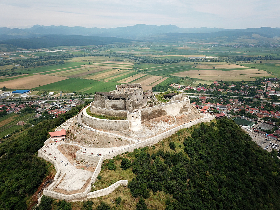
Deva Citadel, Romania
Deva Fortress는 로마시대부터 있던 성으로 기록된다. (아래 자료 참조) 따라서 사수성은 Corvin Castle과 함께 Deva Fortress도 포함되지 않을까 추정한다.
The Fortress of Deva (Romanian: Cetatea Devei, Hungarian: Déva vára) is a fortress located in the city of Deva, Hunedoara County, Romania, on top of a volcanic hill.
Position[edit]
The fortress is located atop a volcano in the Poiana Ruscă Mountain Range within the Western Carpathian Mountains of Romania......
History[edit]
The Roman conquerors strengthened the walls and defended this fortification, the trade road that connected with the rest of the empire, also called the salt road, passed right at the foot of the Hill. And the Mures basin experienced maximum economic prosperity at the time.
In the great year 1269, Deva Fortress is mentioned in a deed of donation of the young Hungarian king Stefan, son of Bela IV, who makes a donation to a Wallachian count for the bravery shown in the battle fought under the walls of Deva Fortress. Then, in 1444, Hungarian John Hunyadi took possession of the Deva Fortress with all its riches: 56 villages and gold mines. Also during his time is mentioned for the first time in a written document the fair of Deva, a settlement at the base of the hill.
(source : Fortress of Deva, wikipedia, 인용출처: 필자의 네이버 블로그(lainfos), 카테고리, Romania)
4. 파노성의 위치 추정
파노성(巴奴城)은 한자의 의미가 별로 없으므로 음가차환의 이름이지 않나 판단한다. 즉 파노니아를 파노로 적지 않았나 한다. 파노성(巴奴城)은 광개토태왕 비문의 수묘인성으로서, 한(韓)은 9가가 간연이 담당하게 했다.
아래 지도는 4세기 당시의 Pannonia지방의 지도이다. 달마티아 지방의 북쪽으로서 현재의 루마니아 지역에 해당한다.
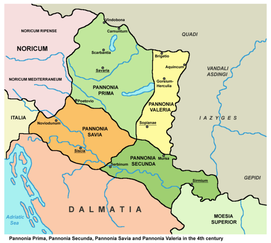
1) Poenari Castle
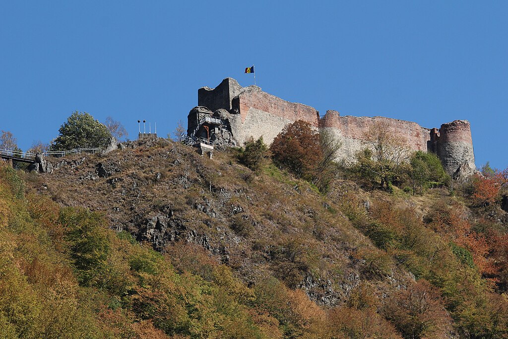
이 파노니아 지방에 파노성과 발음이 유사한 Poenari castle이 있다. 원형 타워가 근간을 이룬다. 15세기 중반에 지었다 하나, 현재의 상태는 그보다 더 오랜 세월을 말하는 것 같다.
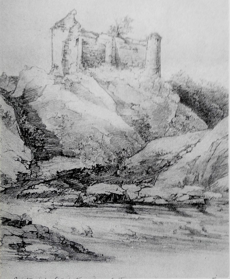
Cetatea_Poenari_by_Gheorghe_Tatarescu_(1860)
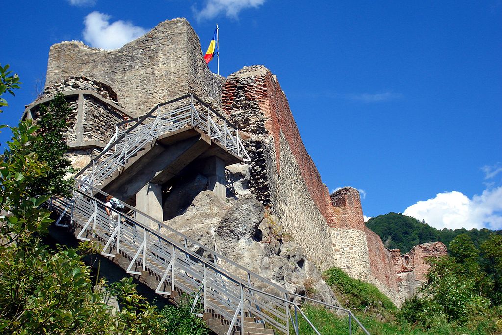
Poenari Castle Romania
Poenari Castle (Romanian pronunciation: [po.eˈnarʲ]), also known as Poenari Citadel (Romanian: Cetatea Poenari) and Poenari Fortress, is a ruined castle in Romania which was a home of Vlad the Impaler.[2] The citadel is situated on top of a mountain and accessed by climbing 1,480 concrete stairs.
Location
The castle is located on the plateau of Mount Cetatea, facing the west side of the Transfăgărășan, on a canyon formed on the Argeș River valley, close to the Făgăraș Mountains.
History
Before Poenari Castle was constructed in the mid-15th century, another castle around the same location was erected near the beginning of the 13th century by the Wallachians, called Castle Argeș.[3] In the mid-14th century, Castle Argeș became the main citadel of the Basarab dynasty.[4][5] In the next few decades, the name and the residents changed a few times but eventually the castle was abandoned and left in ruins......
A modern rendering of Poenari Castle was featured in the 2013 BBC Worldwide/Starz television series Da Vinci's Demons. In the episode titled "The Devil", Leonardo da Vinci travels to Poenari Castle in Wallachia to meet with Vlad the Impaler.
The episode "The Hardy Boys & Nancy Drew Meet Dracula" of The Hardy Boys/Nancy Drew Mysteries show in the '70s takes place inside "Dracula's Castle" in "Poenari". Shots of the castle used in the episode are of Poenari Castle, though the episode shows people driving up to the castle gates for a rock festival, which is not possible.
(source : Poenari castle, wikipedia, 인용출처 :필자의 네이버 블로그(lainfos), 카테고리, Romania)
Poenari성도 Dracula 관련 Show가 열린 곳이기도 하다. 드라큘라는 훈족의 이미지와 관련된 것으로 필자는 추정한다.
III. 마무리말
이상으로 산나성, 사수성, 파노성이 발칸반도에 있다는 추정을 마치고자 한다.
사수성은 사수라는 강에 있는 성이라는 의미인데, Sasu river가 있는 루마니아에 근처에 Corvin Castle이 있고, 성안에는 우물이 있으며, 원형의 타워가 있다. 비록 후에 증축되었으나 훈족의 후손들이 관리 하고 있어, 여러 모로 고구려 성이란 추정이다. 즉 사수성이라 할 수 있다. 바로 옆에는 산 정상에 Deva Fortress가 있는데, 원형 타워의 존재로 볼 때, 사수성의 일부가 되지 않을까 한다.
사수성이 강이름에서 착안했는데, 발칸반도에는 Sana river가 있다. 즉 산나성도 Sana River와 관련된 이름이 아닌가 한다. 한자로는 별 의미가 없는 것을 보면 음가차환의 성이름으로 판단된다. 산나성의 후보로서 여러 가지 성을 검토했으나, Sana River가 합쳐지는 Una river에 있는 Bosanska Krupa castle이 유력한 후보라 판단한다. 원형타워가 근간을 이루고 있고, 관련 자료가 거의 없는 것이 오히려 더 산나성 가능성을 높이고 있다. 위키피디아 자료도 사람이 쓰는지라, 감추고 싶은 역사는 언급하지 않는 경향이 있으며, 지역의 사가들도 마찬가지이다.
Una-Sana river에 있는 Ostrozac castle도 산나성 후보의 하나라 볼 수 있다. 원형 타워도 존재하고 규모도 있다. 13세기에 과거 있던 곳에 증축한 성이 아닌가 한다.
Velika Kladusa Castle도 산나성 후보의 하나이다. 원형타워가 성곽안에 있고, 원형의 치도 보인다.
파노성은 한자의 의미가 없어 음가차환의 이름으로 판단하여 파노니아지방의 유사한 이름 Poenari Castle를 후보로 추정했다. 역시 원형 타워가 근간을 이루고, 오래된 성의 모습이 보인다. 중세에 증축했을 가능성이 높은데, Dracula와 관련 있는 성의 지위가 오히려 고구려 성곽이었을 가능성이 높이고 있다.
이들 지역은 모두 훈족이 395년 겨울 다뉴브강을 건너 공격한 지역에 있는 성들이다. 고구려 광개토태왕이 이 시기에 아리수인 다뉴브강을 건너 백제를 공격했다. 여기서 더 내려가면 백제의 위례성이 있을 수 있는 Dalmatia해안에 Sirmium이 있다. 위례성에서 백제 아신왕은 광개토태왕의 고구려에 항복한 것이 아닌가 한다.
이상의 연구결과는 필자가 추정한 로마는 백제, 고구려는 훈족과 고트족이라는 추정이 맞다는 것을 역으로 방증한다. 그래서 필자는 계속 연구의 의욕을 가진다.
AI를 필자는 별로 좋아하지 않는다. 기존의 잘못된 역사기록에 의거하여 말하고 있기 때문이다. AI에 의존하면 잃어버란 우리의 역사, 감추어진 역사를 발견할 수 없다. 그러나 AI는 이글에서 지형적 조건을 고려한 성곽의 위치를 찾는데 도움을 주었다.
AI관련하여 하나의 여담을 말하고자 한다. 필자는 지난 글에서 진성, 관산성, 구타모라가 코카서스 Lazica지역에 있었다는 글을 썼다. 이들 3개의 성은 모두 근처에 있는 성곽이다. 진성은 삼국유사, 구타모라는 일본서기가 언급한 지역이다. 그런데 AI에게 물어 보니, 관산성은 충주지역, 진성도 비슷한 지역에 있을 것이라 말하고 있으나, 구타모라는 거제도에 있다 말한다. 왜 그러냐고 다그치니 입을 다문다. 한반도 식민사학자들이 만들어 놓은 폐해이다. 서양학자에 못지 않게 역사를 왜곡하는 사람들이다.
'한국의 역사 > 고구려' 카테고리의 다른 글
| 광개토태왕 비문의 송성(松城)은 아드리아해 달미티아 해안에 있었다. (0) | 2026.09.22 |
|---|---|
| 곡튀르크는 돌궐이 아니라 고구려이다 (0) | 2026.06.08 |
| 광개토태왕이 공취한 잡진성은 튀르키예 Isauria 지역에 있었다 (1) | 2025.11.21 |
| 광개토태왕이 공취한 백제의 암문성은 요르단의 Amman Citadel인가? (3) | 2025.10.16 |
| 고구려 대무신왕이 복속 받은 구다국은 어디인가? (0) | 2023.11.04 |