나는 바로 이전에 올린 글 " 광개토대왕이 정복한 백제의 관미성은 흑해의 크리미아에 있다" 란 글에서 백제의 관미성이 가지고 있는 천혜의 자연적 요소에 대하여 검토했다. 이제 구체적으로 관미성이 흑해 크리미아에서 어딘지 추정해 보고자 한다.
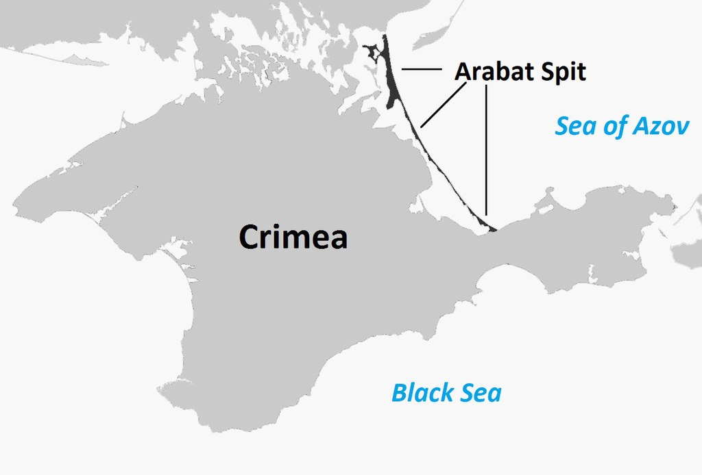
계속해서 살펴본 바에 의하면 광개토대왕이 함락한 백제의 관미성은 흑해의 크리미아반도내에 있는 Arabat Fortress로 판단된다. 이곳은 세계 역사적으로 유명한 전투지역이며 그 천혜의 요새로서 유명한 지역이다. 우선 아라바트성의 특성을 살펴 보고 이곳이 관미성이 될 가능성을 검토하고자 한다. 그 위치는 Arabat Spit의 남쪽 끝지점이다.

Map of Crimea Peninsula (source : Wikipedia)

Ruins of Arabat Fortress in Crimea Peninsula (source : Wikipedia)

관미성으로 추정되는 Arabat Fortress (source : Wikipedia)

Ruins of Arabat Fortress (source : Wikipedia)
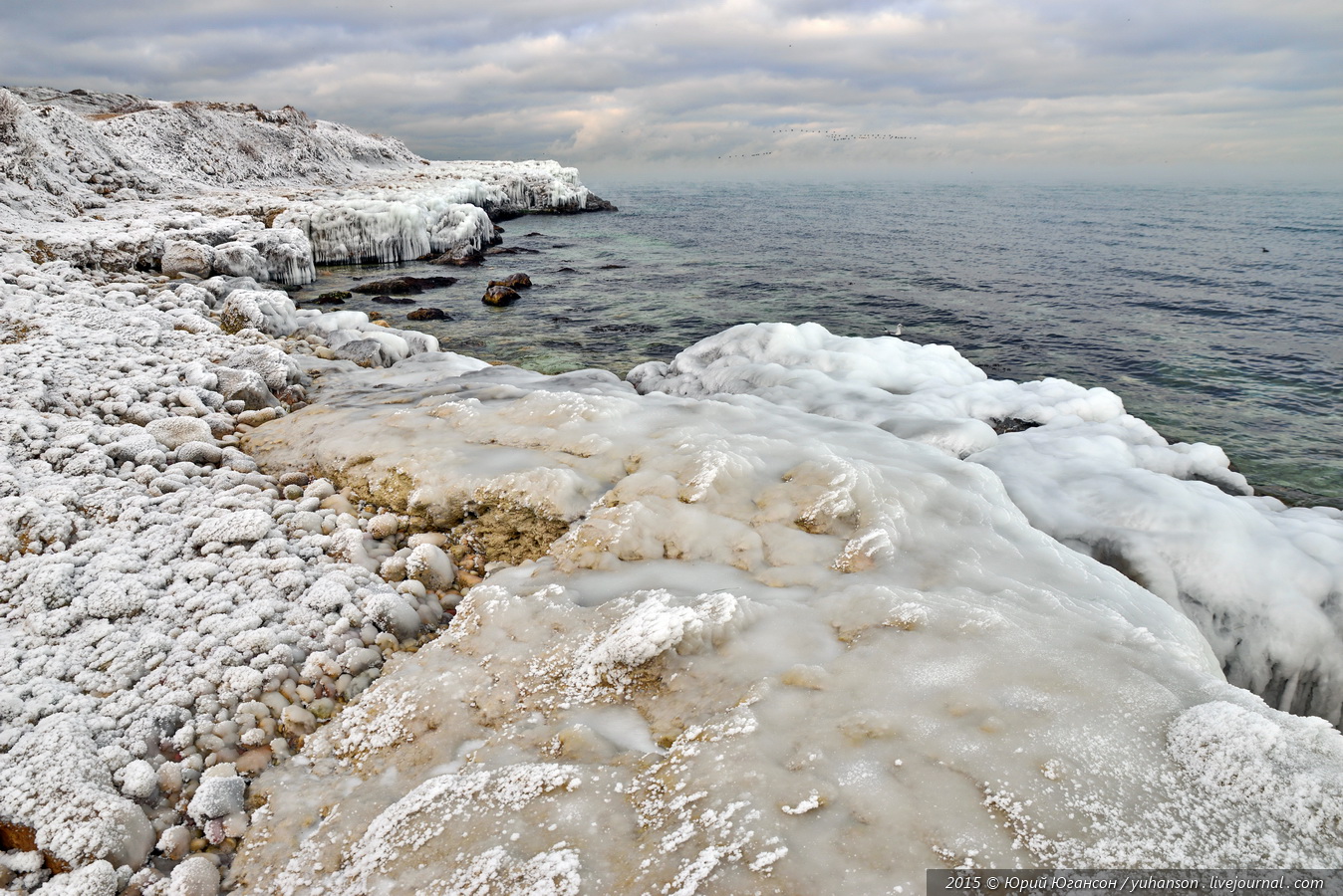
(아)라바트 성곽은 그 자체로 매우 튼튼하게 지어졌다. 바위 두께가 3미터가 된다 했다.(후일 추가적으로 더 쌓을 수 있다). 또한 5개의 Towers와 두개의 gates가 있다 했다. 그리고 더하여 주위에 Arabat Spit이라는 천혜의 방어막을 가지고 있다. 그래서 역사적인 전쟁에서 최근 2차대전까지 항상 중요한 요새가 되었다.
" The Arabat Fortress is located at the southernmost part of Arabat Spit. Its name originates from either Arabic "rabat" meaning a "military post" or Turkic "arabat" meaning a "suburb"[ and is the origin of the name of the Arabat Spit.
Its purpose was to guard the spit and Crimea from invasions.....
The fortress had an advanced military design with octagonal shape and 3-meter thick stone walls surrounded by an earthen wall and a moat. It contained five towers and two gates. Several rows of arrowslits
faced east, north and west and were designed for various artillery types. Whereas the fortress was hard to conquer when properly defended...(source : Wikipedia)
아라바트 곶 (Arabat Spit)이라는 것에 대해 더 살펴 보자.

위성사진으로 본 Arabat Spit(아라바트 곶) (크리미아반도 동북쪽). 이곳의 최남단에 관미성이 있다. (source : Wikipedia)
"The Arabat Spit (Ukrainian: Арабатська коса, Russian: Арабатская коса) or Arabat Arrow is a spit (narrow strip of land) which separates a large, shallow and very salty system of lagoons named Syvash from the Sea of Azov. The spit is located between the Henichesk Strait to the north and the north-eastern shores of Crimea to the south. ...
Its temperature is around 0 °C (32 °F) in winter (near freezing), 10-15 °C (50-59 °F) in spring and autumn, and 25- 30 °C (77- 86 °F) in summer; air temperature is almost the same. (source : Wikipedia)

Arabat Spit (source : Wikipedia)

View of Arabat Spit from Arabat Fortress in Crimea Peninsula (source : Wikipedia)
아라바트곶에서 Syvash란 단어가 나온다. 이것도 또한 알아 둘 필요가 있다.
"The Syvash or Sivash (Russian and Ukrainian: Сива?ш; Crimean Tatar: Sıva?, Cyrillic: Сываш, "dirt"), also known as the Putrid Sea or Rotten Sea (Russian: Гнило?е Мо?ре, Gniloye More; Ukrainian: Гниле? Мо?ре, Hnyle More; Crimean Tatar: Curuk Deniz, Cyrillic: Чюрюк Денъиз), consists of a large system of shallow lagoons on the west coast of the Sea of Azov. Separated from the sea by the narrow Arabat Spit, the water of the Syvash covers an area of around 2,560 km2 (990 sq mi) and the entire area spreads over about 10,000 km2 (3,900 sq mi). Its eastern connection to the Sea of Azov is called the Henichesk Strait. The Syvash borders the northeastern coast of the main Crimean Peninsula; Central and Eastern Syvash registered as wetlands of Ukraine under Ramsar Convention, after the 2014 Russian annexation of Crimea became under a territorial dispute.....
The Syvash nearly cuts the Crimean Peninsula off from the mainland, serving as a natural border for its autonomous republic. The long (110 km or 68 mi) and narrow (0.27-8 km or 0.17-5.0 mi) Arabat Spit runs to its east, separating it from the Sea of Azov. The two bodies are connected in the north at the Henichesk Strait beside the port of Henichesk. To its west, the isthmus of Perekop separates it from the Black Sea and connects Crimea to Ukraine." (source : Wikepedia)
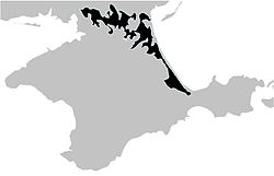
Map of Crimea showing the Syvash in Black (source : Wikipedia)
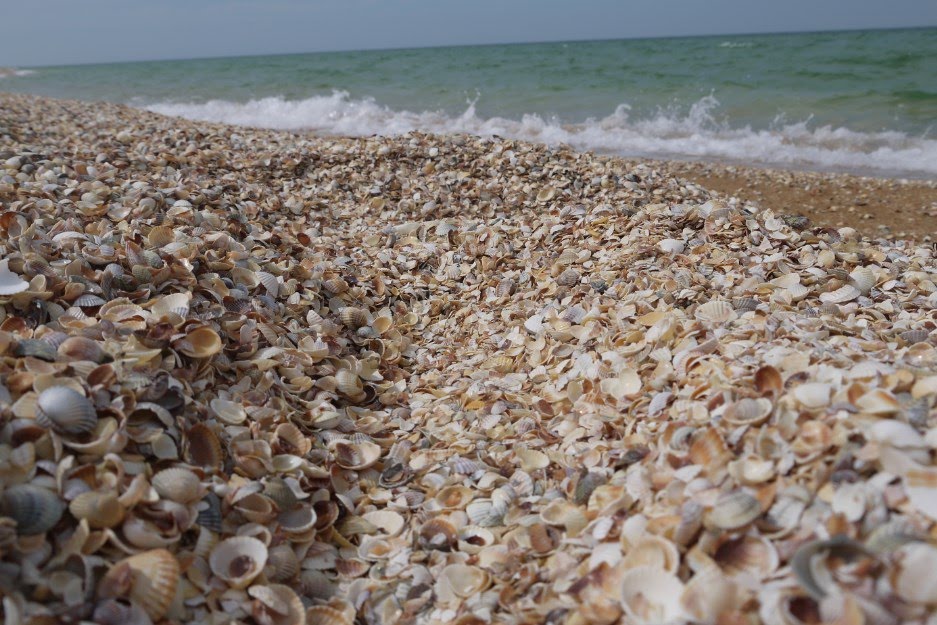
조패류로 가득한 Arabat Spit (source : Wikipedia)
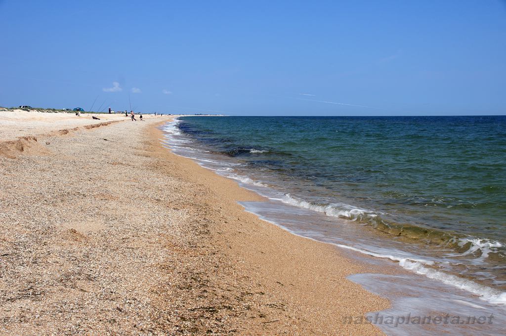
Arabat Spit (아라바트 곶) (source : Wikipedia)
즉 방대한 Arabat Spit이 자연적인 지형으로 아라바트성을 보호하고 있는 것이다. 또한 Syvash란 것이 이곳을 지나가는 것을 막는다.
이러한 아라바트곶 지역을 지나가는 것은 군사적으로 매우 위험한 일이다.
그러나 20세기 들어 건넌 사례가 있다. 아래 그 사진을 보면 위험성을 짐작할 수 있다.
"During the Russian Civil War, the Syvash became famous for a surprise crossing by the Red Army during the Perekop-Chongar Operation." (source : Wikipedia)
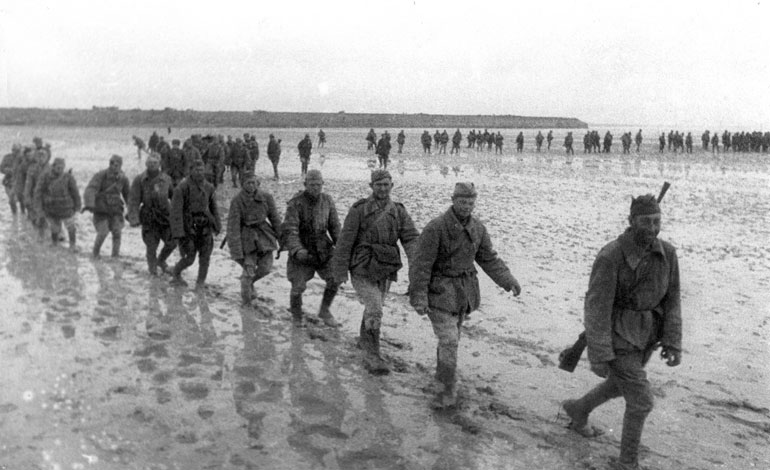
Russian Red Army crossing the Syvash in Crimea Peninsula (source : Wikipedia)
그래서 광개토대왕은 이 아라바트 곶이 얼을 수 있는 - 겨울엔 섭씨 0도 정도이다 - 겨울 (392년 음력 10월)을 선택하여 육군과 수군을 동시에 이용하여 관미성을 공격한 것이다. 고구려는 크리미아 반도 위 지역를 점하고 있었기 때문에, 육로를 통해 크리미아로 남하할 수 있었다 그러나 Syvash가 가로 막고 있었을 텐네, 겨울에는 얼어있기 때문에 건널 수 있었을 것이다.
"호태왕은 2년(392) 임진 7월에 친히 4만의 병력을 이끌고 백제를 공격해 12개의 성을 빼앗고, 군사를 돌려 9월에 거란을 정벌한 후 그곳에 억류되어 있던 유민들과 포로들을 데리고 개선했다. 이어 10월에는 또 다시 수군과 육군을 이끌고 가서 군사를 일곱 길로 나누어 주야로 20일을 쉴 새 없이 공격해 마침내 철옹성인 백제의 관미성(關彌城)을 함락시키고 만다.
관미성은 사면이 가파르고 험하며 해수(海水)로 둘러싸여 있는 난공불락의 요새인지라 백제 진사왕은 절대로 함락되지 않으리라 여기고는 그의 처 가리와 함께 구원(狗原)에서 약 10일간이나 사냥하면서 호태왕이 철군하기를 기다렸다. 그러다가 관미성이 함락되었다는 보고를 받고는 놀라자빠지더니 끝내 그 충격으로 인해 일어나지 못하고 죽어버린다." (자료 : 고구려 역사저널, "백제 아신왕에게 연전연승하는 광개토태왕(6부)")
겨울에 얼어 있는 Crimea Peninsula (source : Wikipedia)
Crimea Mountains and Arabat Spit (아조브해 방향)을 보여주는 지도 (source : Wikipedia)
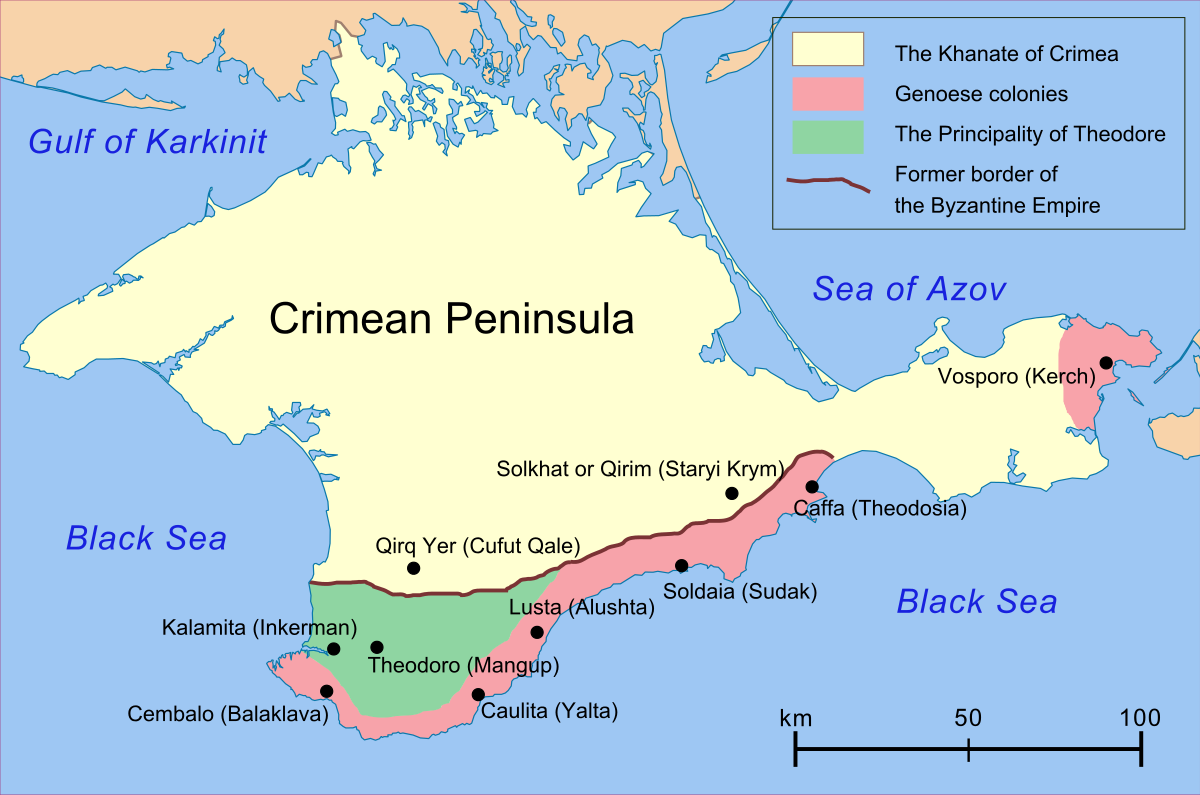
백제 (비잔틴제국)의 역사적 관할지역을 보여 주는 지도 (source : Wikipedia)
이후에도 백제는 관미성을 회복하기 위해 노력했다. 그러나 실패했다. 겨울이 아닌 때를 이용한 탓도 있으리라. 그리고 백제는 비잔틴제국이기 때문에 육로를 이용하지 못하고 수군의 배를 이용하여 공격했을 것이다. 따라서 고구려의 수군 육군을 동시에 이용한 경우와 다르다. 그리고 백제는 해상 보급로가 고구려에 의해 쉽게 차단될 수 있다. 역사적인 기록이 이를 증명해준다.
"호태왕은 이듬해 7월 거란을 쳐서 천서(川西)를 빼앗았다. ....8월, 백제 아신왕이 고구리가 거란을 정벌하고 있다는 정보를 입수하고는, 고구리의 내부방비가 비었을 것으로 판단해 진무로 하여금 석현성과 관미성을 공격하게 했다.
위 기록은 <삼국사기 고구려국본기>에는 “가을 8월, 백제가 남쪽 변방을 침범하기에 장수를 시켜 막게 했다.”라고 간단히 기록되어 있다. 아신왕은 진무장군의 출전에 앞서 이르기를 “관미성은 우리의 북방요새였는데 지금은 고구리의 소유가 되어 있으니 그야말로 가슴이 아프고 애석한 일이로다. 그대는 아무쪼록 마음을 써서 부끄러움을 씻게 해 달라.”고 부탁했다.
드디어 진무는 군사 1만 명을 거느리고 고구리의 남변에 있는 석현성 등 5개의 성을 회복하기 위해 관미성을 포위했다. 진무는 화살처럼 날아오는 돌을 무릅쓰고 몸소 병사들의 진두에 서서 공격했으나, 고구리 병사들이 성문을 닫고 굳게 지키는데다가 군량미가 이어지지 않자 결국 군사를 이끌고 돌아갔다고 한다.
4년(394) 갑오 7월, 백제의 진무가 또 쳐들어왔는데, 호태왕이 기병 5천으로 수곡성 아래에서 매복했다가 맞싸워 거의 모두를 참살했다. 남은 무리들은 산골짜기에 숨었다가 야밤에 달아났다. 8월, 남쪽 변방의 일곱 성을 수리하게 했다."
(출처 : 고구려 역사저널, 상기 동)
백제의 군사들은 산골짜기에 숨었다가 야밤에 도주했다 했다. 즉 크리미아의 산세가 험하다는 말이다. 아래 사진들을 보면 크리마아의 험한 산세를 짐작할 수 있다.
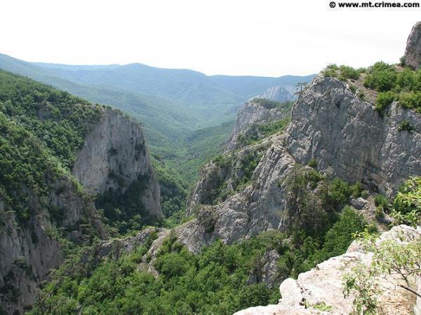
Grand Canyon in Crimea Peninsula (바위산으로 가득한 크리미아 산들) (source : Wikipedia)
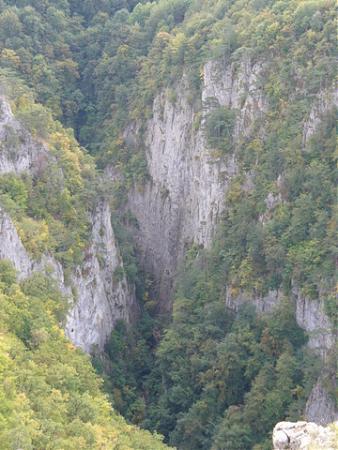
Grand Canyon in Crimea Peninsula (source : Wikipedia)
그리고 광개토태왕은 394년 8월 남쪽 변방의 7개성을 수리하게 했다. 크리미아의 남서쪽 끝의 Balaklava에 있는 Cembalo성, 남쪽 중앙부의 Sudak성, 남쪽 중앙 우측의 Feodosiya에 있는 Caffa성, 남쪽 동쪽끝의 Kerch에 있는 Yeni Kala성, 그리고 Arabat Spit으로 보호받는 관미성으로 추정되는 Arabat Fortress 등을 수리했을 수도 있다. (이에 관한 사진은 본 로그에 올린 글, "광개토대왕이 정복한 백제의 관미성은 흑해의 크리미아에 있다" 참조)
'과거의 생각' 카테고리의 다른 글
| 김수로의 금관가야는 코카서스 산맥 아래 아르메니아지역에 있었다 (0) | 2019.07.24 |
|---|---|
| 백이 숙제의 고죽국은 흑해 위 볼가강가에 있었다 (0) | 2019.02.17 |
| 한무제의 한나라는 페르시아 지역의 Parthian Empire이다 (0) | 2019.02.14 |
| 광개토대왕이 정복한 백제의 관미성은 흑해의 크리미아반도에 있었다 (0) | 2019.02.14 |
| 진시황의 진나라는 알렉산더제국인가? (0) | 2019.02.06 |