I. 서 론
필자는 지난 글 송성에 대해 연구하다가 (아래 글), 우연히 이태리 북부에서 조그만 호숫가 성을 알게 되었다. 그 규모가 작은 것에 놀라기도 했지만, 전략적 위치에 있는 것을 알게 되었다. 그래서 혹시 광개토태왕 비문의 세성이 아닌가 해서 이글을 쓰게 되었다.
https://lostcorea.tistory.com/1945
광개토태왕 비문의 송성(松城)은 아드리아해 달미티아 해안에 있었다.
I. 서 론광개토태왕이 백제로부터 공취한 성 중에서 송성이 있다. 송성의 송(松)은 소나무송자이다. 즉 소나무가 많이 있는 성이라는 것이다. 소나무가 많은 성이라는 이름을 붙인 것은 이곳이
lostcorea.tistory.com
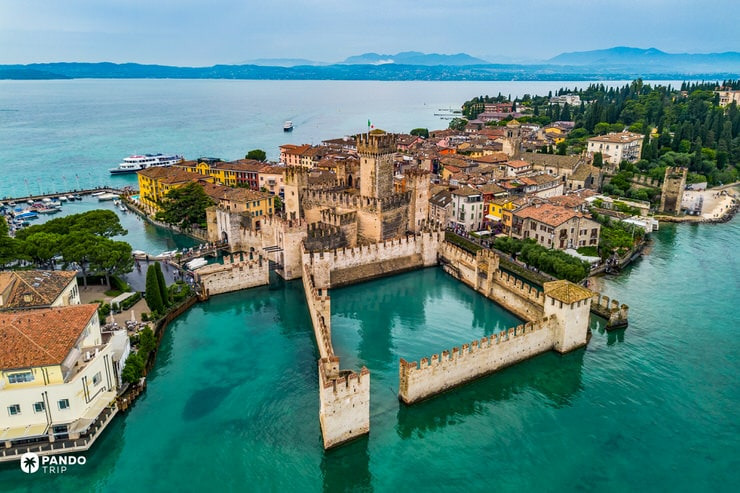
A pocket-sized water fortress where mirror-calm lagoons trade arrows for reflections
(Scaligero stands ankle‑deep in Lake Garda, its pale stone mirrored so cleanly that battlements appear to float. A single drawbridge leads into a courtyard scarcely wider than a postcard, concentrating every ripple and echo of the water. Perfect symmetry, milky‑blue moat and distant Alpine peaks lend the fortress the compact neatness of an illustration – proof that romance sometimes arrives in pocket‑size proportions.)
세성의 세(細)자는 가늘 세이다. 즉 작은 규모의 성을 의미하지 않나 한다. (아래 한자사전 자료 참조) 작은 규모의 성임에도 불구하고 전략적 가치가 높은 성이기에 점령되고 언급되었을 것으로 필자는 판단한다. 또는 음가차환의 이름일 수도 있다고 본다.
細 가늘 세
부수 糸(실사)
1.가늘다
2.자세하다(仔細ㆍ子細--), 상세하다(詳細--)
3.미미하다(微微--), 보잘것없다
细(간체자), 𥿳(고자), 细(동자)
(자료 : 네이버 한자 사전)
II. 본 론
1.The Scaligero Castle or Scaligero Castle of Sirmione
우선 우연히 알게된 Sirmione의 Scaligeri Castle에 대해 알아 보자. 이 성은 그림에서 보는 것처럼 호수가에 있다. Lake Garda이다.
.
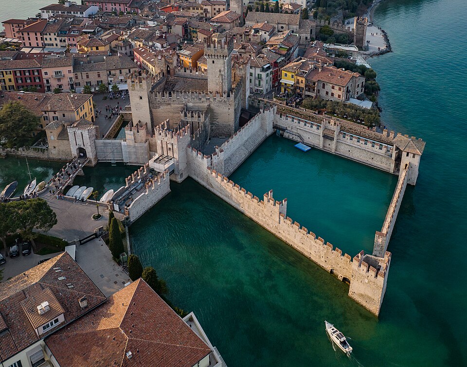
Scaliger Castle of Sirmione
Garda 호수의 남쪽 중앙에 위치 (아래 지도 참조)한 Sirmione Scaligero 성은 여러 모로 세성의 가능성을 가지고 있다.
The Scaligero Castle or Scaligero Castle of Sirmione (Italian: Castello scaligero di Sirmione) is a fortress from the Scaliger era, access point to the historical center of Sirmione, on Lake Garda. It is one of Italy's best preserved castles.[1] In 2019, it was the 22nd most visited attraction in Italy, with 308,459 visitors.[2]
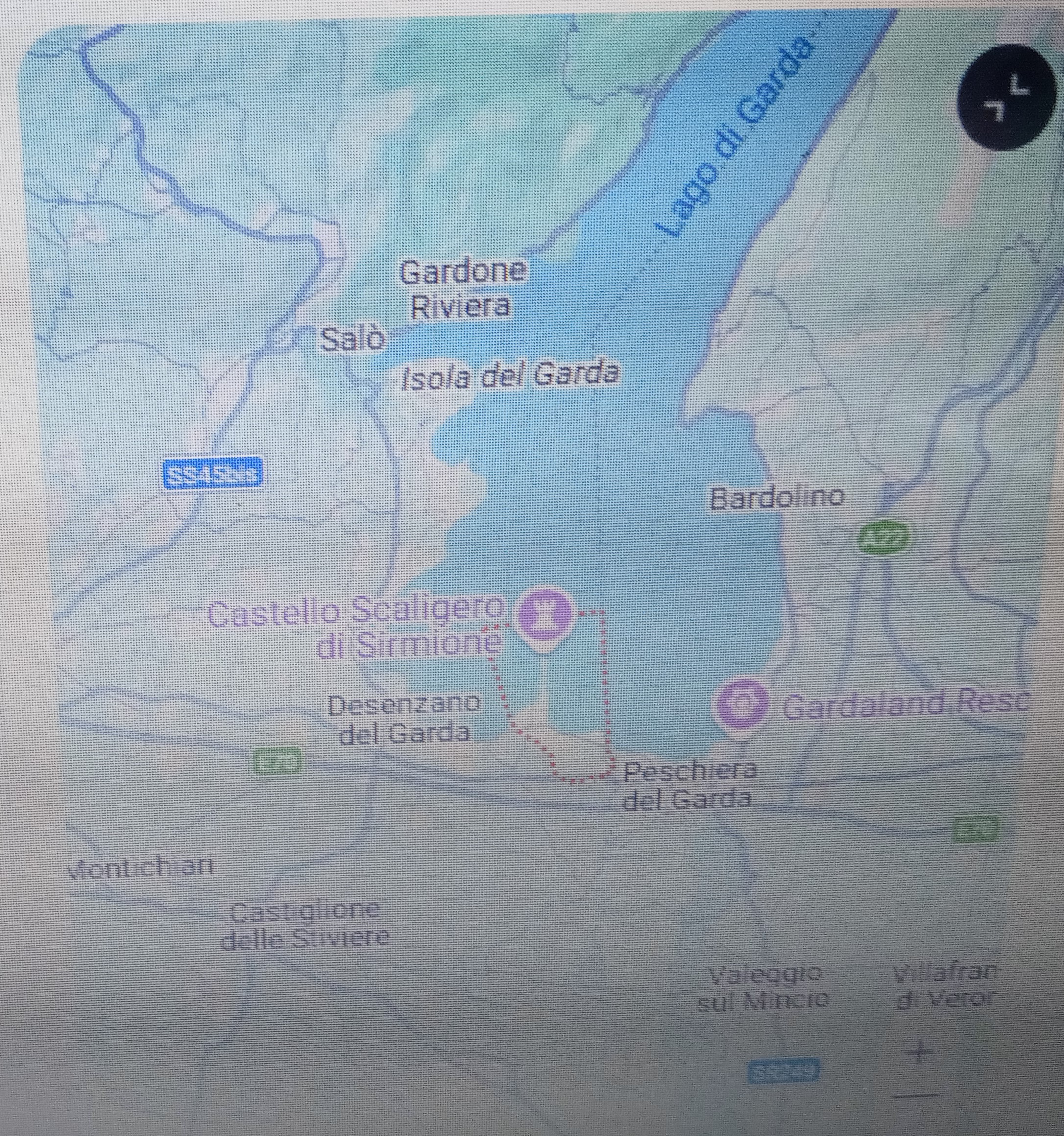
Scaligero Castle of Sirmione (red letter) in Garda Lake (source : Google map)
History
Lake Garda 최남단에 14세기 후반에 이 성을 세웠다 한다. Scaligeri라 알려진 Verona의 Della Scala 가문을 대신하여 건축이 시작되었다. 그래서 이름이 Scaligaro Castle이라 지어졌다. 이 가문은 1259년부터 1387년까지 베로나와 베니치언의 많은 지역을 지배했다. (아래 내용)
It was built in the latter half of the 14th century on the southernmost part of Lake Garda in the Northern Italy. Construction was initiated on behalf of the Della Scala family of Verona, who are known as the Scaligeri, from which it takes its name.[3] The family ruled Verona and a large part of the Venetian area from the years 1259 to 1387.
이 성은 Della Scala가문이 1405년 베니스에 속해진 이후 15세기부터 베니스공화국의 지배하에 있었다. 이 지역에서 계속하여 중요한 요새가 되었다. 그 중요성이 낮아진 것은 16세기에 근처에 Peschiera del Garda요새가 완성된 이후이다. (아래 내용)
The castle was later controlled by the Republic of Venice from the 15th century after the Della Scala family submitted to Venice in 1405. It continued to be an important fortification in the area. Its decline in importance began with the completion of the nearby fortress in Peschiera del Garda in the 16th century.
(source : Scaligaro castle (Sirmione), wikipedia, 인용출처 : 필자의 네이버블로그(lainfos), 카테고리, 이태리성곽)
2. Sirmione
상기 성은 Sirmione지역에 있다. 따라서 이 지역에 대한 역사를 살펴 보자.
Sirmione은 이태리 북부 롬바르디에 있는 Brescia지방의 하나의 comune이다. Verona지방에 접해 있다. 이는 Garda호수의 아래부분을 나누는 Sirmio 반도에 위치한 역사적 중심지이다. (아래 내용 참조)
Sirmione (Brescian: Sirmiù; Venetian: Sirmion) is a comune in the province of Brescia, in Lombardy (northern Italy). It is bounded by Desenzano del Garda (Lombardy) and Peschiera del Garda in the province of Verona and the region of Veneto. It has a historical centre which is located on the Sirmio peninsula that divides the lower part of Lake Garda.
History[edit]
이 지역의 최초의 인류 거주 흔적은 기원전 5-6천년이다. 기원전 1세기에서부터, 이 지역은 Verona시 부유층이나 이태리북동쪽 로마도시로부터 선호되는 리조트가 되었다. (아래 내용 참조)
The first traces of human presence in the area of Sirmione date from the 6th–5th millennia BC. Settlements on palafitte existed in the 3rd and 2nd millennia BC.
Starting from the 1st century BC, the area of the Garda, including what is now Sirmione, became a favourite resort for rich families coming from Verona, then the main Roman city in north-eastern Italy. The poet Catullus praised the beauties of the city and spoke of a villa he had in the area.
AD 4-5세기 로마시기에, 이 도시는 호수의 남쪽 해안을 지키는 요새화된 방위거점이 되었다. 롬바르디가 이태리 북부를 정복한 후에도 거주는 계속되었다. 롬바르디왕국 후기에는 왕에 직속된 사법지역의 수도가 되었다. (아래 내용 참조)
In the late Roman era (4th–5th centuries AD) the city became a fortified strongpoint defending the southern shore of the lake. A settlement existed also after the Lombard conquest of northern Italy: in the late years of the Lombard kingdom, the city was capital of a judiciary district directly subordinated to the king. Ansa, wife of King Desiderius, founded a monastery and a church in the city.[3]
1000년경에는 Sirmione은 자유지역이었는데, 13세기에는 Scaliger 가문의 손에 들어갔다. Mastino I della Scala가 아마도 이성을 세운 자일 것이다. 이 도시의 군사적 역할은 16세기까지 계속되었고, 병력은 19세기까지 성안에 주둔했다. (아래 내용 참조)
Around the year 1000, Sirmione was probably a free comune, but fell into the hands of the Scaliger in the early 13th century. Mastino I della Scala was probably the founder of the castle. In the same period, Sirmione was refuge for Patarines hereticals. The military role of the city continued until the 16th century, but a garrison remained in the castle until the 19th century.
Sirmione는 1405년부터 1797년까지 베네치아 공화국에 속했다. 이후는 합스부르그제국에 속했다. 1860년에 이태리왕국의 일부가 되었다. (아래 내용)
Sirmione was a possession of the Venetian Republic from 1405 until 1797, when it was acquired by the Habsburg Empire. It became part of the Kingdom of Italy in 1860.
(source : Sirmione, wikipedia, 인용출처 : 필자의 네이버 블로그(lainfos), 카테고리, 이태리)
3. Lake Garda
상기 성은 Garda호수의 방위거점이 되었다 한다. 그래서 Garda 호수에 대해 좀더 알아 보자.
오늘날 Garda호수로 더 알려진 이 이름은 중세이래 게르만 오리진의 지명이며, 이 호수의 베로나연안의 동명의 타운으로부터 연유되었다. 예를 들면 호수의 가장 유명한 지역, Gardone Riveiera, 그리고 덜 유명한 다른 이름, Gardola, Gardoncino, Gardoni, Guàrdola, Le Garde 등의 이름으로부터이다. 그리고 이것은 이 지역에 6-8세기동안 게르만인의 존재를 증명한다. Garda란 이름은 게르만 단어 Warda에서 진화했는데, 이 뜻은 '경비의 장소', '감시의 장소', '안전을 위한 장소' 등의 뜻이라 한다. (아래 내용 참조)
Today it is better known as Lake Garda, a toponym of Germanic origin attested since the Middle Ages and deriving from that of the homonymous town on the Veronese shore of the lake, which, together with another famous locality of the lake, Gardone Riviera, and others less known – such as Gàrdola, Gardoncino, Gardoni, Guàrdola and Le Garde – testifies to the Germanic presence in the area that dated from the 6th to the 8th century CE, in particular, the Lombard one. The name Garda is evolved from the Germanic word warda, meaning "place of guard", "place of observation" or "place of safety".[1]
이 지역은 롬바르드 이전에 고트족의 지배영역이었다는 것을 상기하자. 앞에서 살펴 본 Scaligero Castle of Sirmione 성은 4-5세기이래 군사적 중요 방어 거점이었다는 것을 상기하자. 고트족의 Alaric I, 즉 광개토태왕의 원정 경로에 해당할 수 있다는 것이다. 특히 그 이름이 게르만족 언어(서양사에서 고트족은 게르만족의 일부로 설명함)에서 비롯되었으며, 이 호수 주위에 유사한 이름이 많이 존재한다는 것 또한 이를 암시해 준다.
이 호수의 전통적 이름, Benacus lacua (Benaco)는 켈트족 오리진이 거의 확실하며, 그러므로 로마화 이전의 것으로, "horned"(뿔모양의 돌기가 있는)를 의미하는 아일랜드어 bennach와 비교되는, bennacus로부터 연유되었을 것이다. (아래 내용)
The classic toponym of the lake, or Benācus lacus (Benaco), is almost certainly of Celtic origin, therefore prior to romanization, and should derive from bennacus, comparable with the Irish bennach, which means "horned". The term may derive from the many promontories of the lake...........
이 호수의 전통적 이름, Benacus는 켈트족의 언어에서 비롯되었다는 것이다. 필자는 켈트족의 유럽역사가 고조선의 역사가 아닌가 추정했다. (아래 필자의 글 참조). 광개토태왕은 고조선의 유민들을 구하기 위해 많은 원정을 했다고 한다.
https://lostcorea.tistory.com/1914
Danes족 유전자 분포지역은 고조선 영역인가? (종합)
I. 머리말 Danes족은 덴마크지역을 홈랜드로 하는 부족이다. 필자는 이 지역이 단군과 관련 있는 지역이 아닌가 추정한다. 덴마크지역이 기원후 500년경의 두막루가 있던 지역으로 추정된다. 두막
lostcorea.tistory.com
아래 그림은 Garda호수의 전체 모형을 나타낸다. 길죽한 모습이 가늘다라는 표현과 관계가 있지 않을까 생각이 든다.
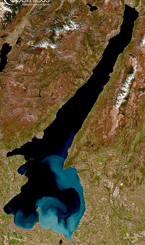
Lake Garda 지형학적 형상 (자료 : 위키피디아)
아래 지도는 Verona와 아주 가까이 있는 Lake Garda를 보여 준다. 즉 Lake Garda는 좌측의 Brescia와 우측의 Verona 중간지점에 있다.

Verona와 근접한 Lake Garda 위치 지도 (자료 : Google map)
Islands
이 호수에는 여러 조그만 섬들이 있으나 5개의 주요 섬들이 있으며, 가장 큰 섬은 Isola del Garda이다. 남쪽 가까이는 San Biagio 섬이 있으며, Isola dei Conigli ("토끼 섬")이라 불리기도 한다. 두 섬 모두 호수의 서쪽에 San Felice del Benaco 해안에서 떨어져 있다. 나머지 3개의 주요 섬들은 Isola dell'Olive, Isola di Sogno, 그리고 Isola di Trimelone이며, 모두 보다 북쪽에 동쪽에 있다. (아래 내용)
The lake has also numerous small islands and five main ones, the largest being Isola del Garda. Nearby to the south is San Biagio island, also known as the Isola dei Conigli ("island of the rabbits"). Both are offshore of San Felice del Benaco, on the lake's western side. The three other main islands are Isola dell'Olivo, Isola di Sogno, and Isola di Trimelone, all farther north near the eastern side......
Roman times
Garda 지역을 통제하는 Cenomani부족과 로마와의 융합은 아마도 BC 225년 시작되었다. 이때에 Cenomani부족, Veneti부족과 로마가 동맹조약을 맺었다. 그러나 이 지역의 실질적 로마화는 기원전 2세기와 기원전 1세기 사이에 이루어였다. (아래 내용)
The integration between Romans and Cenomani, who controlled the Garda area, probably began in 225 BC, when there was a treaty of alliance between Cenomani, Veneti and Romans, even if the actual Romanization of the territory took place between the 2nd and 1st centuries BC....
AD 268년에는 로마제국(미래 황제가 되는 Claudius Gothicus지휘)과 Alamanni 게르만연방사이에 Battle of Benacus전쟁이 벌어졌다. 로마의 압도적인 승리는 전쟁에서 매우 심각한 피해를 입은 Alemanni를 북이태리에서 추방하게 했다. (아래 내용)
In 268 AD the Battle of Lake Benacus was fought between the army of the Roman Empire, commanded by the future emperor Claudius Gothicus, and the German federation of the Alamanni. The overwhelming victory obtained by the Romans allowed the expulsion of Alemanni from northern Italy, due to the very serious losses they suffered during the battle.
로마의 이 지역존재는 빌라 (특히 Grottoes of Catullus) 등의 거주, 오늘날까지도 볼 수 있는 로마의 토지분할체계의 잔존, 성역, 묘비석, 비문의 존재 등으로 광범위하게 증명된다. (아래 내용)
The Roman presence is amply testified also by settlements, villas (in particular the notes Grottoes of Catullus), by the remains of centuriation still visible today, by the remains of sanctuaries, tombstones and epigraphic testimonies.
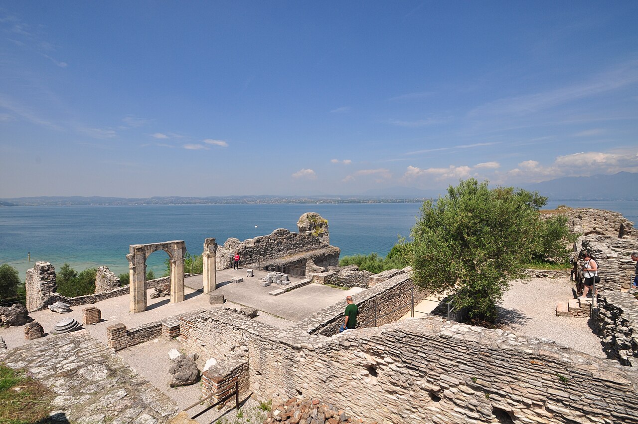
Grottoes of Catullus in Sirmione
로마제국의 붕괴이후, Garda지역은 많은 게르만인들이 지나갔다. 그러나 긴 이동끝에 여기에 정착한 최초의 사람들은 Lombards사람들이었다. 이를 입증하는 증거들은 남쪽과 동쪽의 해안에 대부분 있고, 이 지역은 전략적 중요성 때문에 다른 지역에 비해 선호되었다 : 여기서 Garda 수로와 Mincio, Adige 계곡을 통제할 수 있었다. 이 호수는 3개의 힘있는 Lombard 공국 : Brescia, Verona, Trento 사이의 경계에 있었다. (아래 내용)
After the collapse of the Roman Empire, the Garda region witnessed the passage of numerous Germanic populations, but the first one that settled there, after a long migration, was that of the Lombards. Their testimonies are mostly present along the southern and eastern shores, preferred to other areas due to their strategic importance: from here it was possible to control both the waterways of Garda and Mincio, and the Adige valley. During the Lombard hegemony, there was a first administrative reorganization, as well as the definitive Christianization of the area, begun in the previous centuries by Vigilius of Trent and Zeno of Verona. The lake remained on the border between three powerful Lombard duchies: Brescia, Verona and Trento.
(source : Lake Garda, wikipedia, 인용출처 : 필자의 네이버 블로그(lainfos), 카테고리, 이태리)
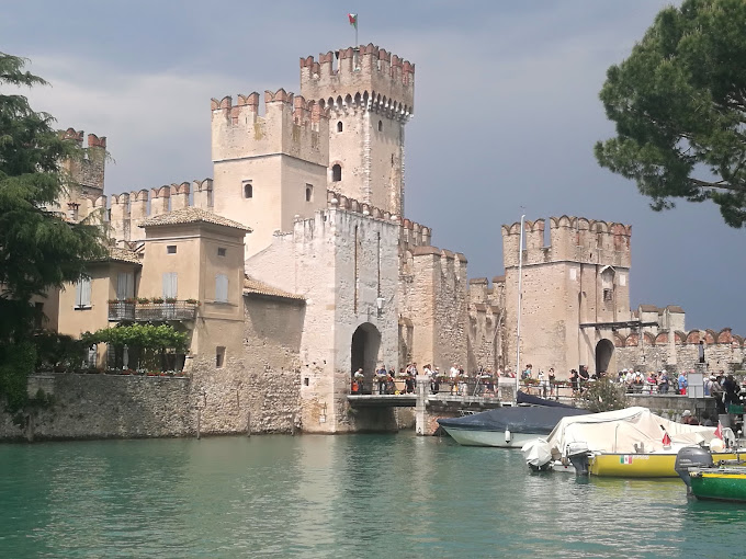
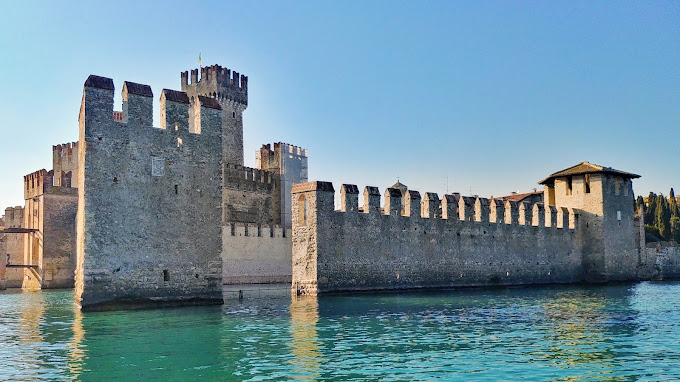
4. Scaligero Castle of Sirmione의 여러 모습들
아래 사진들은 가르다 호수의 남쪽 Sirmione에 있는 성의 모습들이다.



5. Padenghe sul Garda : Southwest side castle of lake Garda
Garda호수의 남서쪽에 Padenghe sul Garda 타운이 있는데, 여기에 성이 있다. (아래 지도 참조) 그래서 성이름도 타운이름대로 지어졌다.
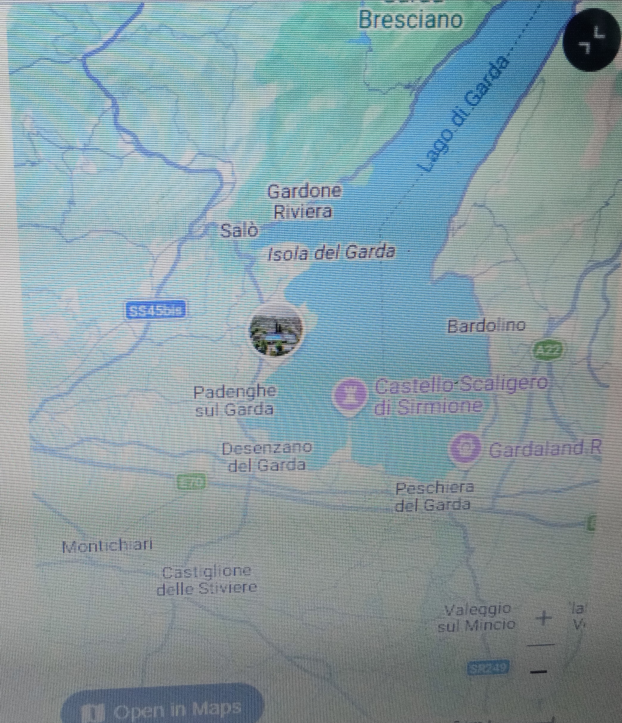
Padenghe sul Garda location (source : Google Map)
이 성은 호수에서 조금 안쪽으로 언덕 정상에 있다. (아래 사진 참조)
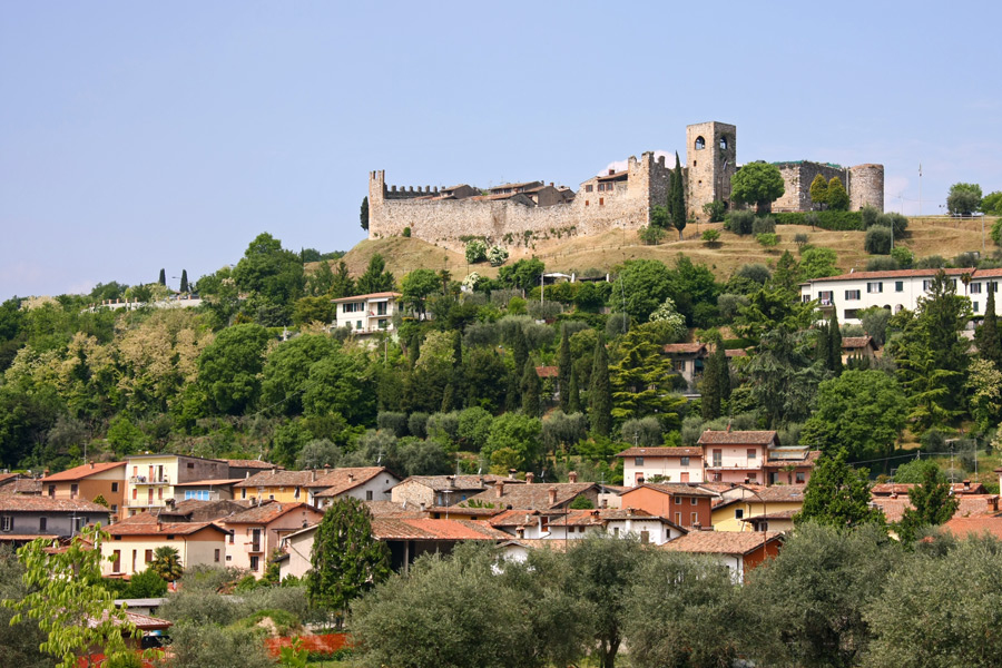
Padenghe sul Garda is a town and comune in the province of Brescia, in Lombardy. It is situated on the southwest coast of Lake Garda.[3] Neighbouring communes are Calvagese della Riviera, Desenzano del Garda, Lonato del Garda, Moniga del Garda and Soiano del Lago.
Padenghe sul Garda는 롬바르디에 있는 타운이며 Brescia지방에 속한 comune이다. Garda호수의 남서쪽에 위치한다. 이웃 Comunes들은 Calvagese della Riviera, Desenzano del Garda, Lonato del Garda, Moniga del Garda, Soiano del Lago 등이다. (상기 내용)
History
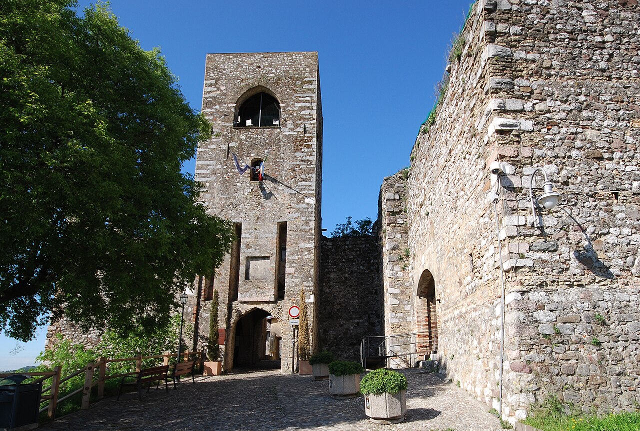
The entrance of the medieval castle.

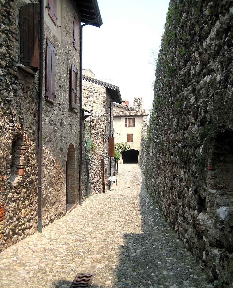
Padenghe castle interior
선사시기의 거주 흔적, 화살촉 등이 토탄늪에서 발견되었다. 최근의 발견은 로마인의 흔적을 말해 준다. (아래 내용)
Traces of prehistoric settlements have been found (arrowheads) in the peat bogs. More recent findings attest to the Roman presence.
9-10세기에 걸친 항가리언의 침입으로, 주민들은 언덕에 요새를 만들게 되어 성곽이 세워졌다. (아래 내용 참조)
In the Christian era Padenghe depended on the Parish of Desenzano and the first church, San Cassiano, was built next to the town center by the lake. This first village was abandoned because of the Hungarian invasions, straddling the 9th and 10th centuries, which forced the inhabitants to fortify a hill, where the castle was erected. In 1154 Padenghe is mentioned in the document with which Frederick Barbarossa, after the Diet of Roncaglia, recognizes the rights of Theobald, Bishop of Verona on certain territories in province of Brescia.
중세시기에는 성곽은 황제당원의 요새로 변하였으며, Brescia와 Verona사이에 있었다. (아래 내용 참조)
In the Middle Ages, the castle turned it into a Ghibelline fortress and was contested between Brescia and Verona. In 1330 Padenghe was conquered by the Scala family, who were driven by John of Bohemia, son of Henry VII. In 1362, the Cansignorio took the castle, but lost it two years later. At the end of the XIV century the town requested and obtained autonomy from the ruling Visconti. Each country had its own statutes.
..........
Medieval castle
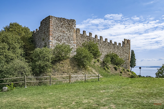
중세의 성곽은 본래의 구조를 보존했다: 거석으로 된 튼튼한 성벽과 북서쪽의 3개의 바워 (중앙것은 붕괴됨). 입구 위로, 다리를 들어 올려 걸어 오는 길 등의 흔적과 함께, 주요 감시탑(사각형의 총안이 없는 벽)이 서있다. (아래 내용 참조)
It has preserved its original structure: solid walls of large stones and three towers (the central collapsed) on the north-west. Above the entrance, with traces of openings of the drawbridge and a pedestrian walkway, stands the main tower, square, without battlements. The castle and the garrison lived in castellino, built later in the curtain.
(source : Padenghe sul Garda, wikipedia, 인용출처 : 필자의 네이버 블로그(lainfos), 카테고리, 이태리)
6. Padenghe sul Garda 성의 여러 모습들

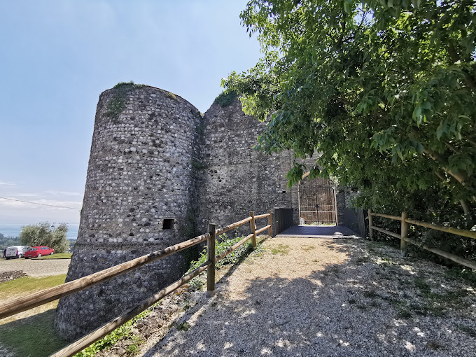
원형의 감시탑 모습이 있다.
사각형의 감시탑도 있다.
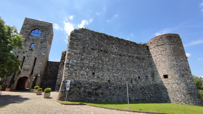
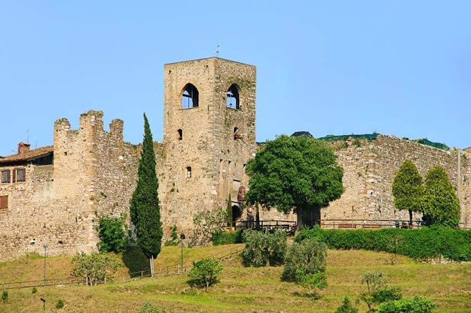
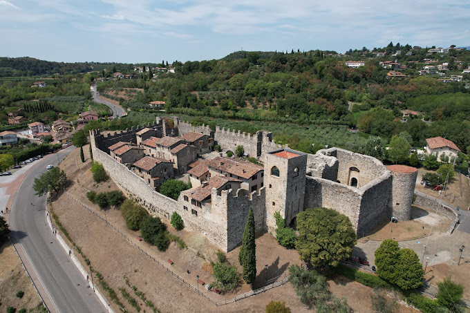
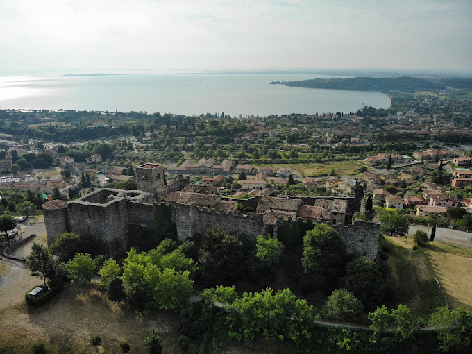
원형의 감시탑과 사가형의 감시탑이 공존하는데, 오래된 모습으로 보아, 베네치아인이 세운 것 같지는 않다.
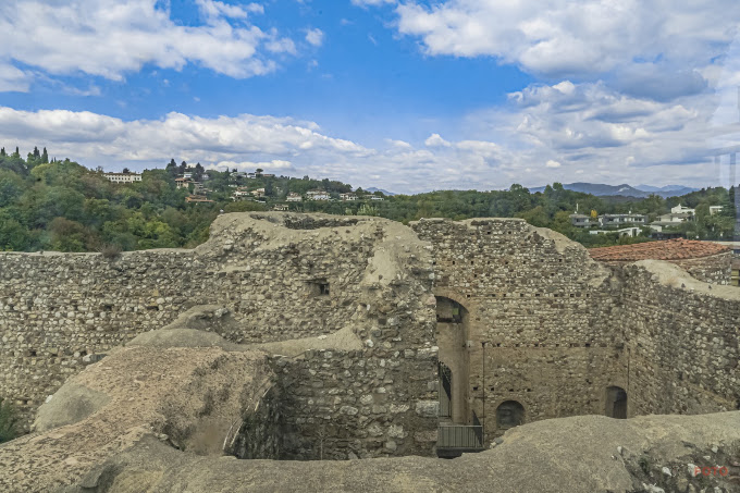
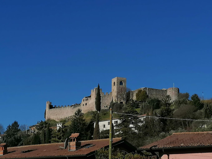
상기 성곽의 모습은 로마의 성곽과 여기에 고트족의 성곽이 추가된 모습으로 추정할 수 있다. 그러나 세성이란 작은 성이란 이름에는 어울리지 않는다.
7. Malcesine castle of lake Garda
Malcesine 성곽은 Garda호수의 북동쪽에 위치한 성이다. (아래 지도 참조)
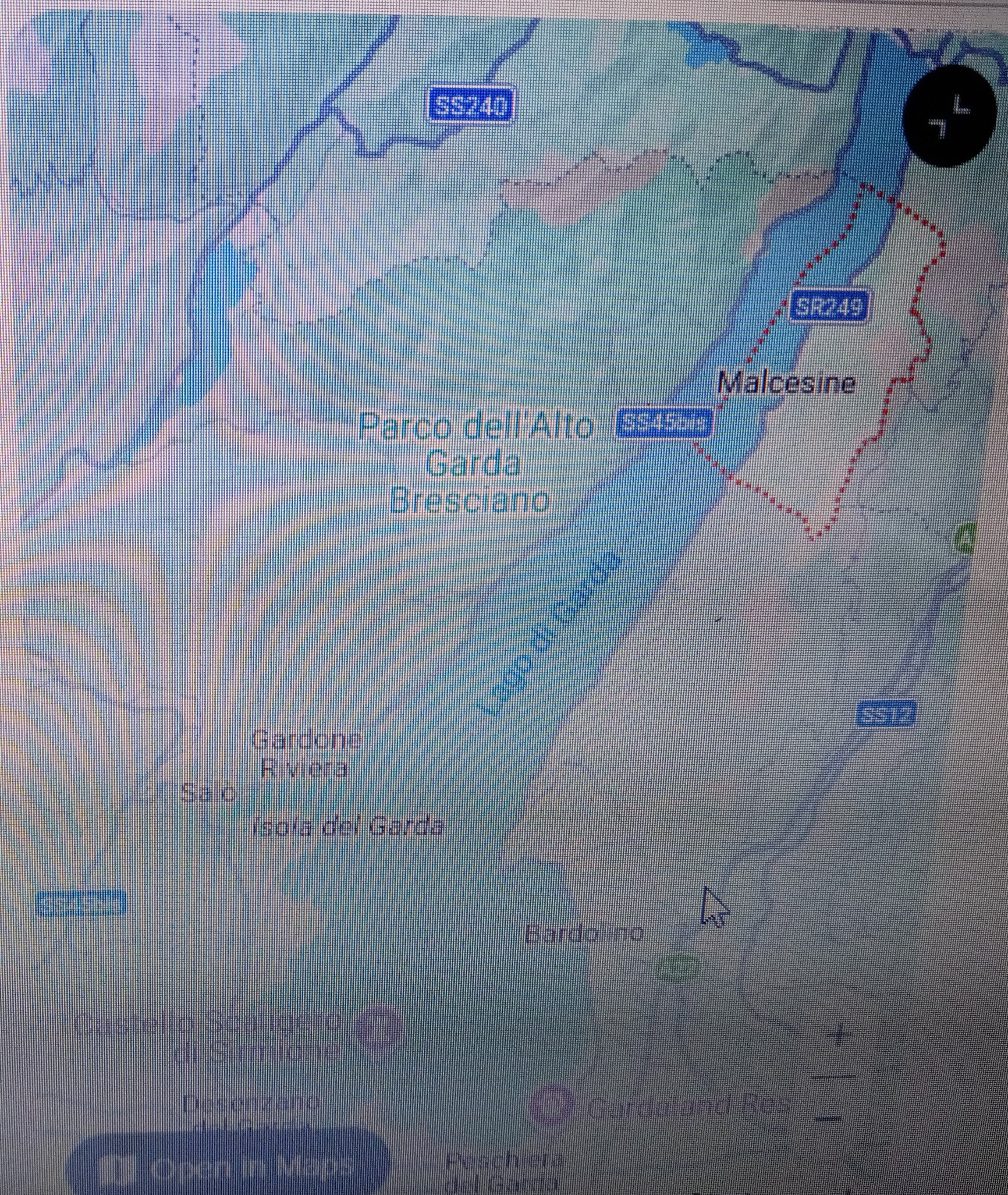
Malcesine location in lake Garda (source : Google Map)
아래 사진을 보면 성곽 요새라기 보다는 호숫가에 위치한 감시탑의 성격을 보인다.

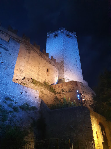
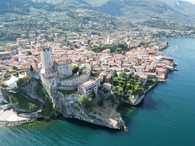
Castle of Malcesine in lake Garda (source : Internet)
8. Garda lake 주위성의 광개토태왕 정복지 가능성
그럼 이제 본격적으로 이태리 북부에 있는 Garda lake주위의 작은 성들이 광개토태왕 비문의 세성일 될 수 있는지 알아 보자. 이 지역이 광개토태왕으로 추정되는 고트족의 Alaric I왕의 원정행로에 있는지 살펴 보고자 한다.
필자는 광개토태왕으로 추정되는 고트족왕 Alaric I이 Verona와 Pollenzo에서 싸운 전투가 고구려의 신성과 남소성의 전투라 추정했다. (아래 필자의 글 참조)
https://lainfos.tistory.com/512
광개토태왕이 싸운 신성(新城)과 남소성(南蘇城)은 알프스산맥 아래 있었다.
I. 머리말 광개토태왕이 후연과 싸운 신성과 남소성의 싸움은 광개토태왕이 전투에서 패배한 기록으로 유일하다. 그래서 이러한 특징에 근거하여 신성과 남소성의 위치를 추정하고자 한다. 단
lainfos.tistory.com
상기 글에서 고트족 왕 Alaric I과 싸운 Stillicho는 후연의 모용희가 아닌가 했다. 그리고 신성과 남소성 싸움은 400년 광개토태왕이 모용희에게 패하였으나 402년에 승리하여 이 성들을 다시 빼앗은 것으로 한국사는 기록한다.(아래 자료 참조)
"400년(광개토왕 10) 후연(後燕)의 모용희(慕容熙)의 침공으로 한때 신성(新城)과 함께 빼앗겼다. 이 때 국경지방 700여 리를 잃었으나 402년에 다시 탈환한 고구려의 북서지방 요충지이다."
(자료 : 남소성, 한국민족문화대백과)
Verona와 Pollenzo전투에서, 고트족 역사가와 로마사가들이 서로 이겼다고 주장하는 이유가 여기에 있다고 추정했다. 광개토태왕 비문에 남소성, 신성이 백제에게서 공취한 성으로 기술되고 수묘인 성에도 등장하는 것으로 볼 때, 고구려가 다시 차지한 것으로 판단된다.
필자는 상기 글에서 전략적 교통의 요지인 Verona가 역시 전략적 교통 요지인 신성이라 판단했다. 여기서 이 Verona성인 Castelvecchio을 언급하는 것은, 바로 필자가 세성이라 판단하는 Garda 호수의 성이, 고트족의 침입경로에 있다는 것을 말하고자 함이다.
이미 Alaric I 왕은 Venice도 유린하였다고 위키자료는 말하고 있고 (아래 자료 참조), Verona도 Alaric I의 공취성으로 판단되는 만큼, 이 지역에 이웃한 Garda 호수지역(아래 지도 참조)이, 광개토태왕의 공취지역으로 매우 유력하다는 것이 필자의 추정이다.
Beginning as early as AD 166–168, the Quadi and Marcomanni destroyed the main Roman town in the area, present-day Oderzo. This part of Roman Italy was again overrun in the early 5th century by the Visigoths and, some 50 years later, by the Huns led by Attila.
(source : Venice, wikipedia, 인용출처 : 필자의 네이버블로그 (lainfos), 카테고리, 이태리)
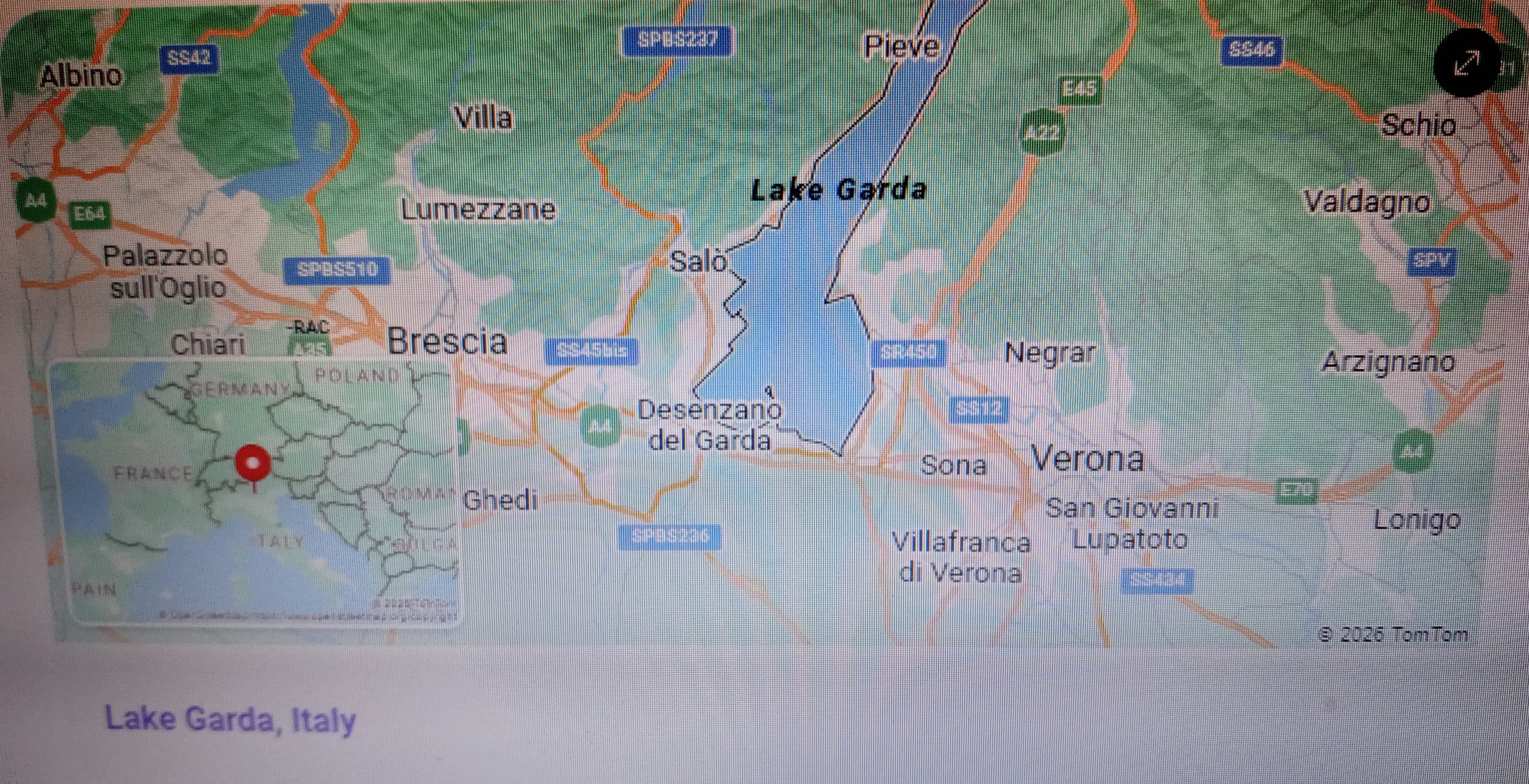
Verona 서쪽에 이웃한 Garda lake 위치 (자료 : Google Map)
9. Omis castles
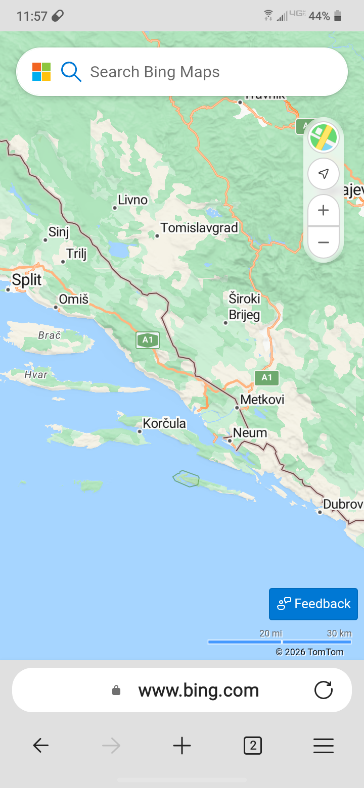
광개토왕 비문에 신성, 송성, 세성이 나란히 열거된다. 따라서 송성 근처에 세성이 있을 수 있다는 생각에 이 달마티아 해안지역을 조사해 보았다. 그런데 Omis 지역(아래 지도 참조)에 있는 작은 성이 해적들의 피난처가 되었다는 것을 알게 되었다. 주위의 지형적 이점을 안고 있는 성이리라. 그래서 검토하게 되었다.
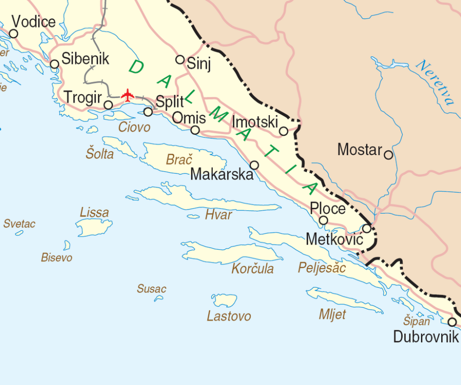
달마티아 해안 지역의 지도 (자료 : 위키피디아)
(1) Mirabella Fortress (Peovica) in Omis
Mirabella Fortress (Peovica) is a fortress located above town of Omiš in Split-Dalmatia County, in Dalmatia, Croatia.
Mirabella 또는 Peovica는 13세기에 Omis타운위에 세워진 로마네스크 양식의 요새이다. Mirabella 요새는 Omis 해적들이 안전한 Cetina 계곡으로 후퇴하여 믿을만한 은신처였다. 전설에 의하면 1537년에 튀르크가 공격하는 동안, Omis 방어자들은 소리를 쳐서 침범자들을 혼동하게 하여 튀르크인들이 방어하는 사람들이 많은 것으로 잘못판단하고 도망갔다 한다. (아래 내용)
Mirabella or Peovica is a Romanesque fortress, built in the 13th century above the town of Omiš by the Kačić family.[1] Mirabella was a reliable hideout for the Omiš pirates who used to retreat into the safety of the Cetina gorge. Legend says that in 1537, during an attack by the Turks, the defenders of Omiš confused the attackers with their shouting and shots so much that the Turks overestimated the number of defenders and fled.
(source : Mirabella Fortress, wikipedia,인용출처 : 필자의 네이버블로그(lainfos),
카테고리, 크로아티아)
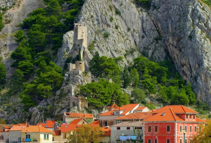
Omis mirabella fortress (source : Wikipedia)
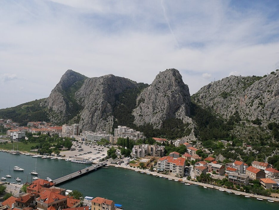
Omis bridge (source : Wikipedia)
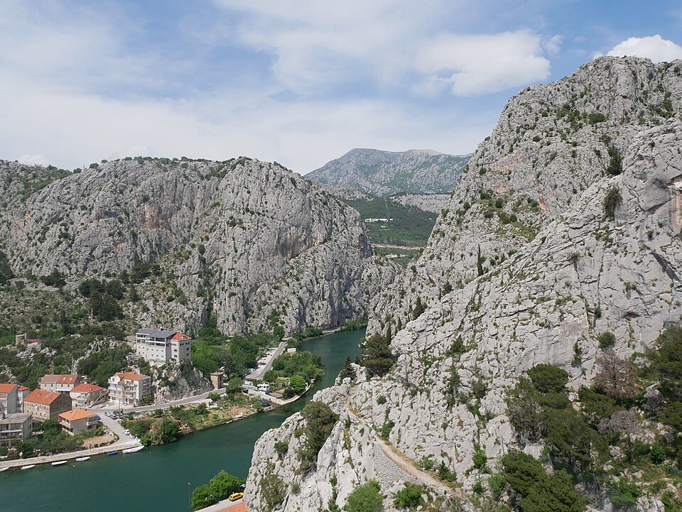
River Cetina Canyon (source : Wikipedia)
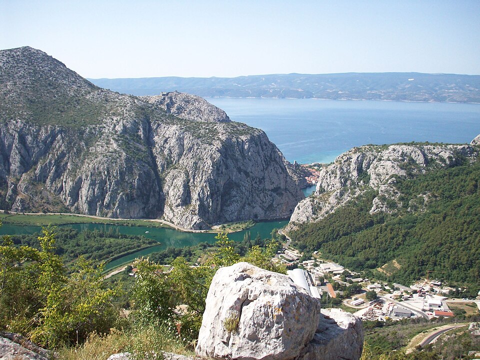
Cetina river mouth at Omis (source : wikipedia)
상기 Mirabella성은 지형적인 조건으로 피난처가 될 군사적 요새의 조건을 갖추었다. 만약 로마군이 Alaric I의 추격에 도망쳐 은신할 수 있는 곳이다. 상기 처음 사진 속의 타워도 원형과 사각형이 공존한다. 세성이라 할 만한 작은 성이다. 그러면서도 지형적으로 매우 전략적인 곳이다. 세성의 될 가능성이 충분한 것이다.
(2) Starigrad Fortress (Omis Fortica)
Omis에 또 하나의 성이 있다. 15세기에 지어젔다는 Omis Fortica Stari Grad Fortress이다. 요새라는 표현이 더 정확한 것 같다. Stari Grad란 Old town이라는 뜻이다.
Starigrad Fortress is a 15th-century fortress located near Omiš in Split-Dalmatia county, in Dalmatia, Croatia.[1]
이 요새는 크로아티아-오스만 전쟁에동안에 오스만 제국에 대한 일차 방어장소로 지어졌다. 이 요새는 Omis타운위 262미터 정상에 가파른 절벽위에 위치한다. 공격당했을 때에, 이 요새의 목적은 지역 사람들이 피난처로 이용하고 튀르크에 버티기 위한 요새로서 역할을 위한 것이다. (아래 내용)
The fortress or Fortica was built during the Croatian–Ottoman wars as a primary defence against the Ottoman Empire. The precipitous fortification is sited on a 262 m (860 ft) ridge above the town Omiš. In the event of attack, its purpose was to provide refuge for local people and be a stronghold where they could retreat to and resist the Turks.
이 석조 요새의 방어 강점은 높은 위치에 있는 것이며, 가장 기본적인 방어 구조이다. 이층 구조의 사각 타워가 가장 높은 곳에 위치하여, 감시탑의 역할을 하고 있다. 이 요새의 건너 끝에 간단한 보루가 있는데, 이는 능선과 접근로를 방어하기 위한 것이다. 바깥에는 요새의 좁은 진입문을 방어하고 요새아래의 계곡을 감시하기 위한 감시망루가 있다. 성벽은 약 1m의 두께이며 지역에서 나오는 화강암으로 만들어졌다. (아래 내용)
As the stone fort's defensive strength is derived from the elevation at which it was built, it is a rudimentary defensive structure. A two-storey square tower stands at its highest point, serving as both a lookout post and keep. A simple bastion stands at the opposite end of the fort to cover the approach path and the ridge line. It has an outer barbican to defend the fort's narrow entrance gateway and the gorge below the fort. The walls, which are about 1 m (3 ft 3 in) thick, are made from locally quarried limestone.
그들은 외벽안의 성곽내 공간으로 둘러싸여 있는데, 이는 이 장소의 자연적인 암석 높이의 차이에 의해 두개의 구분된 높이에 의해 분리되어 있다. 두 높이 사이의 접근은 소규모의 돌계단으로 통하게 되어 있는데, 이는 석조 성벽과 출입로에 의해 보호되어 있다. 공격당할 때에 요새의 모형은 방어진들이 각각의 높이에서 실패할 경우 보다 높은 곳으로 후퇴하는 방식을 가능하게 한다. (아래 내용)
They enclose an inner bailey that is separated into two distinct levels by the difference in the site's natural rock height. Access between the levels is via a small stone stairway that was once protected by a stone wall and gateway. In event of attack, the fortification's design permits the defenders to fall back to higher ground as each level falls.
(source : Starigrad fortress, wikipedia, 인용출처 : 필자의 네이버블로그(lainfos), 카테고리, 크로아티아)
이 요새의 구조는 매우 군사적 요새로서 치밀한 모형을 가지고 있다. 그래서 매우 전략적인 위치에 있는 요새라는 판단이다. 따라서 이러한 전략적인 위치의 요새는 이미 오래전부터의 역사가 있을 것으로 판단된다. 따라서 15세기에 지어졌다는 것은 기존의 요새를 증축한 것으로 볼 수 있다. 고고학적 분석이 없는 것이 아쉽다. 상기 성곽의 모습은 아래 사진과 같다.
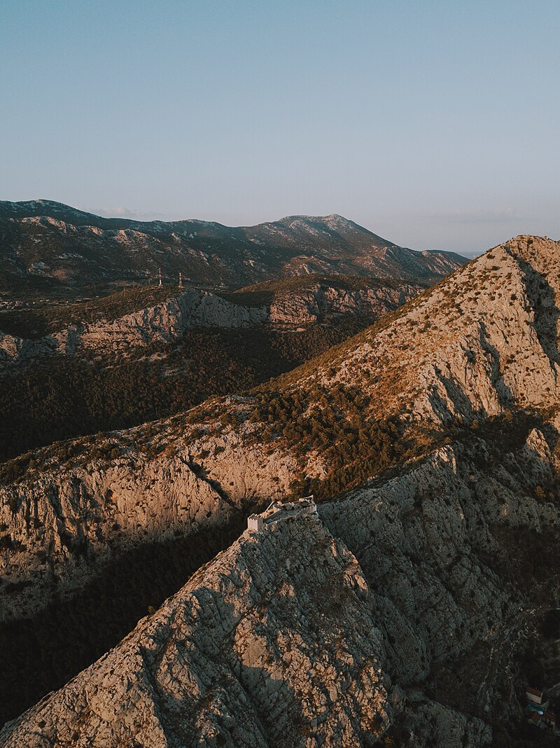
Stari Grad Fortica at Sunset (source : wikipedia)

Omis Fortress (source : Internet)
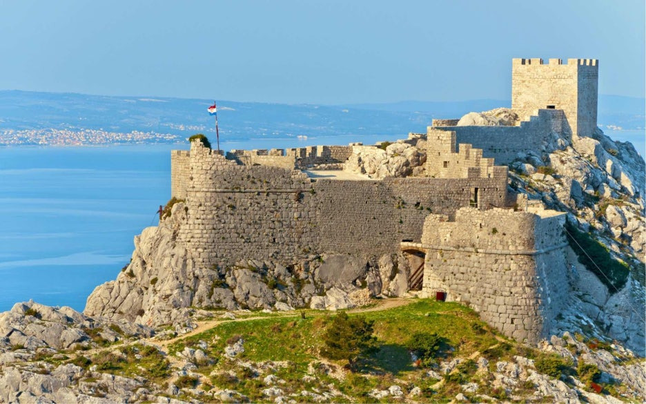
Omis Fortica Fortress (source : Wikipedia)
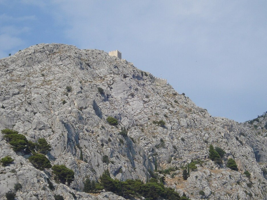
262미터 높이에 있는 가파른 절벽 위의 성곽 (자료 : 위키피디아)
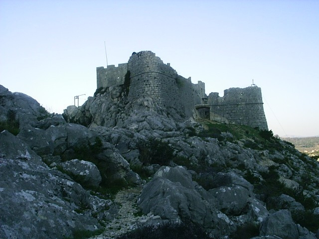
The approach and gateway into Starigrad was protected by a bastion (center) and a barbican (right). (source : Wikipedia)
(3) Omis에 대한 역사
Omis에 대해서는 중세이후 역사만 기술하고 있다. 그러나 이웃한 Split역사에서 간단히 언급한 아래 내용이 눈길을 끈다. 즉 대부분의 달마티아 영역과 함께 동고트족의 영역이었다는 언급이다.
Between 475 and 480, the Palace hosted Flavius Julius Nepos, the last recognised Emperor of the Western Roman Empire. Salona was lost to the Ostrogothic Kingdom in 493, along with most of Dalmatia, but the Emperor Justinian I regained Dalmatia in 535–536.
(source : Split, wikipedia, 카테고리, 크로아티아)
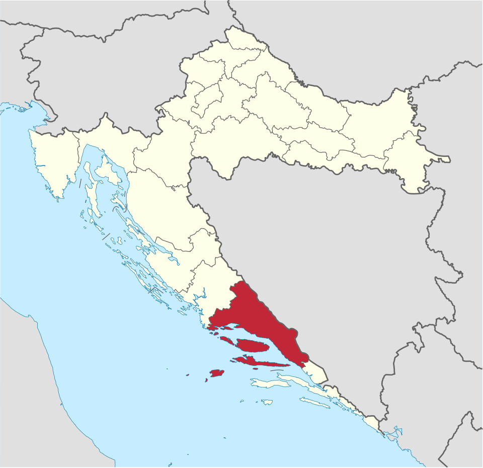
Split- Dalmatia county in Croatia (source : wikipedia)
The name Dalmatia comes from an Illyrian tribe called the Dalmatae who inhabited the area of the eastern Adriatic coast in the 1st millennium BC. It was part of the Illyrian kingdom from the 4th century BC until the Illyrian Wars in the 220s BC and 168 BC when the Roman Republic established its protectorate south of the river Neretva. Dalmatia as a geographical name was in use probably from the second half of the 2nd century BC for the area spanning the eastern Adriatic coast between the Krka and Neretva rivers.[6][7] It was slowly incorporated into Roman possessions until the province of Illyricum was formally established c. 32–27 BC.
Dalmatia became part of the Roman province of Illyricum. In 9 AD, the Dalmatians raised the final of a series of revolts[8] together with the Pannonians, but it was finally crushed, and in 10 AD, Illyricum was split into two provinces, Pannonia and Dalmatia which spread into larger area inland to cover all of the Dinaric Alps and most of the eastern Adriatic coast.[9] Dalmatia was the birthplace of the Roman Emperor Diocletian, who constructed Diocletian's Palace in the core of what is now Split.[10]
(source : Split-Dalmatia county, wikipedia, 카테고리, 크로아티아)
상기 내용은 Split Dalmatia County지역이 기원전 4세기부터 일리리언의 역사가 있었고, 일리리언 전쟁이후 로마의 역사지역이라는 것이다. 디오클레티온 궁전이 Split (Salona)지역에 있었다고 한다. 필자는 이것이 위례성에 있는 백제 책계왕 시기의 궁전이 아닌가 한다.
이러한 것을 감안 할 때, Omis지역의 요새도 로마와 고트족의 영역이었을 것이며, 광개토태왕의 정벌지의 하나가 될 수 있다는 것이다. 즉 세성이 Omis 이곳에 있을 수도 있다는 추정이다.
III. 마무리말
광개토태왕의 비문에 나타나는 세성이 있을 가능성이 있는 두 지역을 살펴 보았다. 하나는 Garda 호수에 있는 성들이고, 이들은 자그마한 성곽의 모습과 세로로 긴 Garda호수에 위치하여 세성이란 의미와 유사한 모습을 보이고 있다. 다른 하나의 지역은 달마티아 해안에 있는 Omis지역으로 조그만 전략적 성이란 의미로 세성을 판단할 때, 역시 가능성을 보여 준다.
필자의 판단은 어느 한 지역을 지정하기는 어렵다 생각한다. Garda 호수의 성 중에는 Sirmione에 있는 성과 Padelghe sul Garda성이 유력한 후보로 보인다. Omis지역에서는 Mirabella성과 Stari Grad Fortica 모두 가능성이 있다고 본다. 원형 타워가 있는 곳은 Garda 호수의 Padelghe Sul Garda성과 Omis의 Mirabella성이다.
그리고 양 지역 모두 고대로부터 일리리언 역사와 로마의 역사가 있는 지역이며, 달마티아와 Verona지역을 점령한 고트족의 역사지역이다. 따라서 두 지역 모두 고트족의 Alaric I의 원정지역이며, 이는 곧 광개토태왕의 원정지역이다.
고트족과 로마의 역사를 보면, 고트족의 Alaric I, 즉 광개토태왕의 정벌지역은 이후 다시 장수왕 시기(훈족의 Attila시기, Odoacer시기)에 다시 정벌하는 모습을 보이며, 이후 문자왕 시기(고트족의 Theodoric the Great)에 고구려의 지역으로 다스린 지역이 된다. 이후 백제의 성왕으로 추정되는 비잔틴의 Justinian I왕은 이들 지역을 회복하면서, 기존에 있던 건축물들을 허물고 다시 건축하는 행위를 반복한다. 즉 반복된 경우를 보이는 것은 그것이 실제 역사라는 의미를 준다.
따라서 이 글에서 추정한 세성의 위치도 이태리 북부나 달마티아 해안에 있을 것으로 추정된다. 송성과 가까이 있다는 순서(비문에 신성, 송성, 세성의 순)에 의한 추정을 한다면 Omis지역의 성곽이 보다 더 가능성이 크다 할 것이다.
'한국의 역사 > 고구려' 카테고리의 다른 글
| 광개토태왕 비문의 송성(松城)은 아드리아해 달미티아 해안에 있었다. (0) | 2026.09.22 |
|---|---|
| 광개토태왕 비문의 산나성, 사수성, 파노성은 발칸반도에 있었다. (0) | 2026.09.17 |
| 곡튀르크는 돌궐이 아니라 고구려이다 (0) | 2026.06.08 |
| 광개토태왕이 공취한 잡진성은 튀르키예 Isauria 지역에 있었다 (1) | 2025.11.21 |
| 광개토태왕이 공취한 백제의 암문성은 요르단의 Amman Citadel인가? (3) | 2025.10.16 |